The earthquake(s) – Witness interview
Watch this very interesting video
Bibliography used for estimating the range of possible fault model for tsunami modelling
- Ambraseys N., 1960. The seismic sea wave of July 9, 1956 in the Greek archipelago, JGR, 65, 4, 1257-1265.
- Brüstle A. et al., 2014. Focal mechanism and depth of the 1956 Amorgos earthquake twin earthquakes from waveform matching of analogue seismograms, Solid Earth, 5, 1027-1044.
- Evelpidou N. et al., 2012. Evidence of a recent rapid subsidence in the S-E Cyclades (Greece): An effect of the 1956 Amorgos earthquake?, Continental Shelf Research, 39-40, 27-40.
- Konstantinou K., 2010. Crustal rheology of the Santorini-Amorgos zone: Implications for the nucleation depth and rupture extend of the 9 July 1956 Amorgos earthquake, southern Aegean, Journal of Geodynamics, 50, 400-409.
- Nomikou P. et al., 2018. Expanding extension, subsidence and lateral segmentation within the Santorini-Amorgos basins during Quaternary: Implications for the 1956 Amorgos events, central-south Aegean sea, Greece, Tectonophysics, 722, 138-153.
- Okal E. et al., 2009. The 1956 earthquake and tsunami of Amorgos, Greece, GJI, 178, 1533-1554.
- Papadopoulos G.A. and Pavlides S.B, 1992. The large 1956 earthquake in the South Aegean: Macroseismic field configuration, faulting, and neotectonics of Amorgos Island, EPSL, 113, 386-396.
- Stiros S. et al., 1994. Quaternary uplift and tilting of Amorgos Island (southern Aegean) and the 1956 earthquake, EPSL, 128, 65-76.
Fault parameters used to make a model of tsunami
The model1 is a blend of the fault models proposed by Okal 2009, Brüstle 2014, Stiros 1994 and Nomikou 2018!
- Centre of the upper edge of the fault: 25.78°E, 36.64°N
- Azimuth 40°, dip angle towards SSE: 30°
- Lenght 60 km, width 20 km (thus depth of the lower edge 20 km)
- Slip: normal component 1.85 m, right lateral component 0.60 m
Input file for Inverse3/Inverse6 codes:
- amor1.inv :parameters
- amor1.txt :location of some sites where witnesses exist according to Okal 2009 or Stiros 1994.
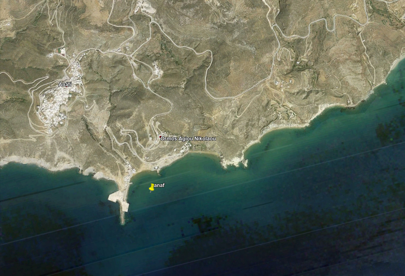
According to model1, the only harbour where the static vertical motion exceeds 0.1 m is the small wharf of Anafi (-0.26 m) but we have not found witness of such subsidence.
KMZ file with the location of the fault (model 1)
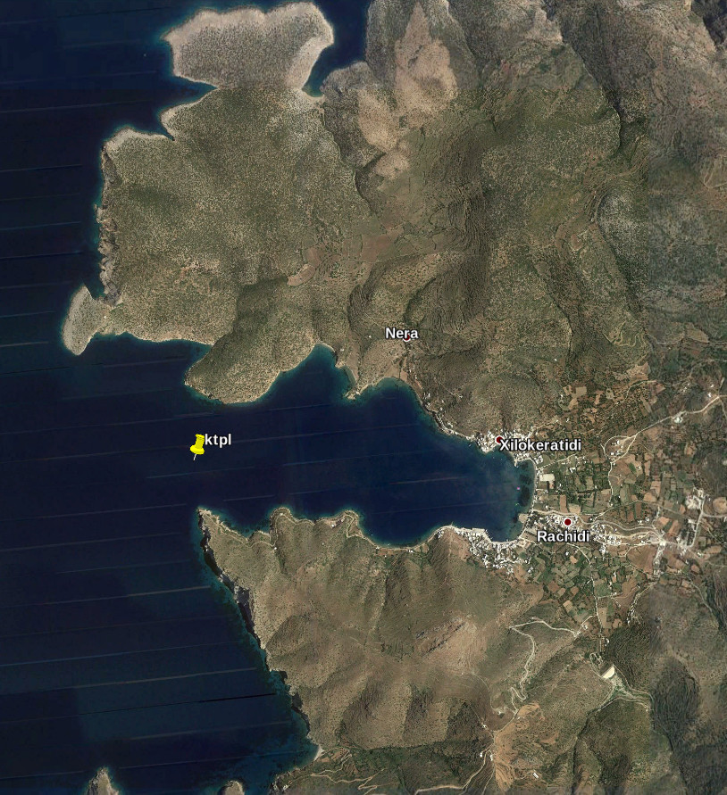
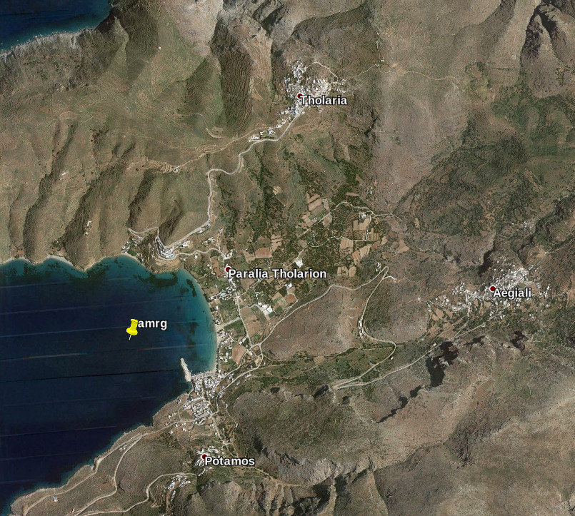
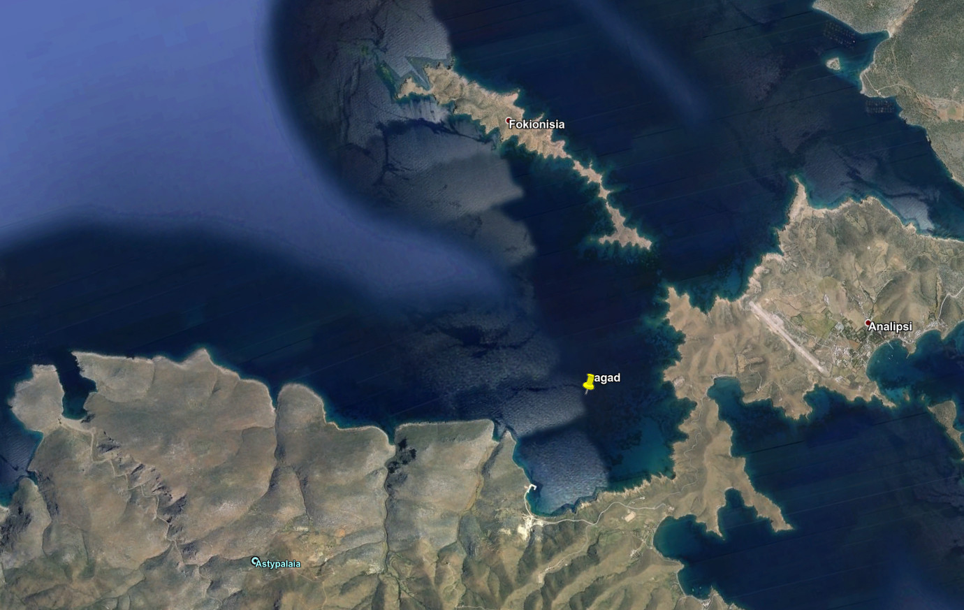
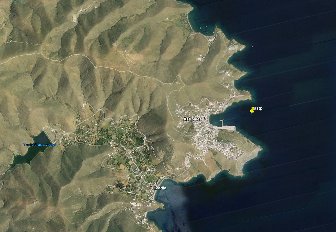
Location of the fault of model 1 at the time 0 with the vertical static displacement produced by the earthquake and location of the ten points where we calculated the tsunami wave. Click of the map to zoom on those points. Note that we place those points not at the coast of the harbours but a little bit off-shore in order to be less dependent on the impact of the errors of our bathymetry in out modelling.
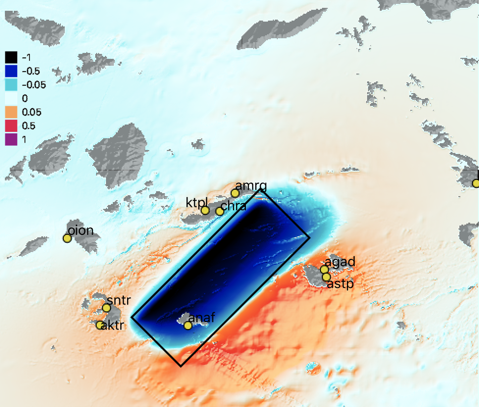
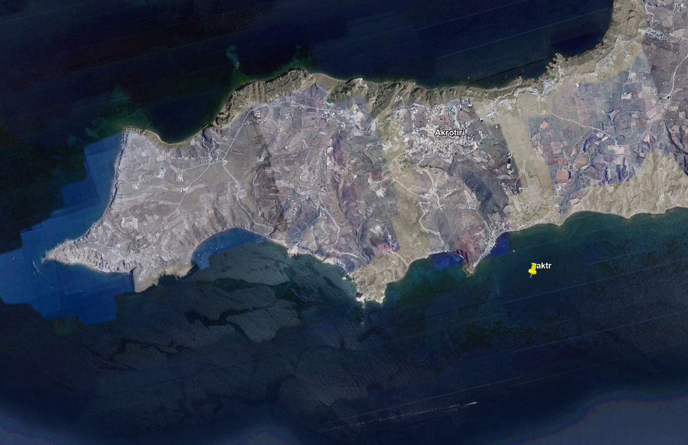
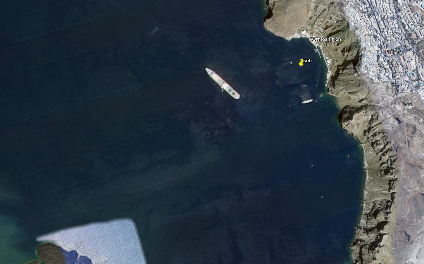
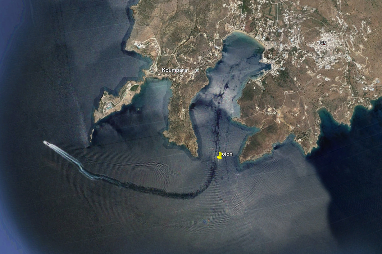
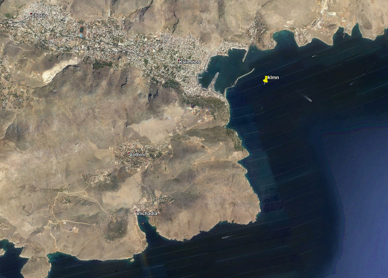
The ten « measurement » sites:
| Code | Location | East | North |
| chra | Chora | 25.9081 | 36.8260 |
| ktpl | Katapola | 25.8460 | 36.8306 |
| amrg | Amorgos | 25.9715 | 36.9035 |
| agad | Ormos Aigiou Andra | 26.3501 | 36.5803 |
| astp | Astypalia | 26.3591 | 36.5477 |
| anaf | Anafi | 25.7721 | 36.3432 |
| aktr | Akrotiri | 25.4008 | 36.3452 |
| sntr | Thira | 25.4265 | 36.4171 |
| oion | Ormos Iou | 25.2622 | 36.7133 |
| klmn | Kalimnou | 36.7133 | 36.9449 |
Model of tsunami made with CLIONA (©CEA/DASE) by Simon Bufféral on February 28, 2020
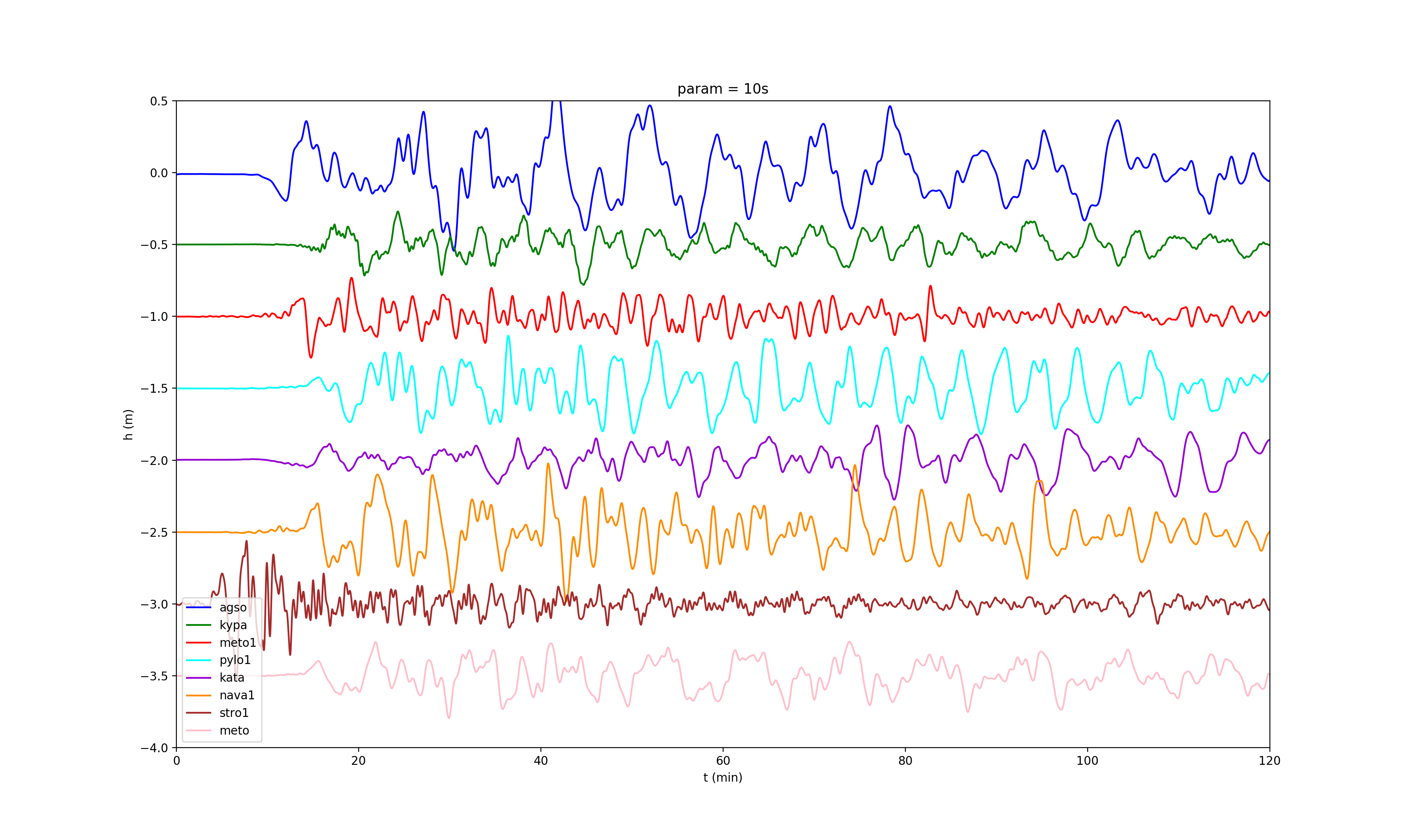
Modelled waves at the ten test sites