
Available batymetry data of the rift of Corinth
- EMODNET
- EMODNET high resolution – Data file (13Mo) – Link web emodnet
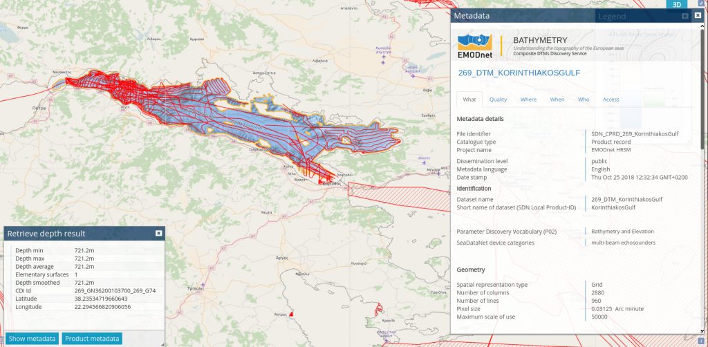

.csv (667183 points (depth average)) and .vrt ASCII files for use in GDAL (verify integrity with the instruction « ogrinfo 269_KorinthiakosGulf.csv »)
The EMO file is a comma separated file containing the following fields (see bottom of this page):
- Longitude
- Latitude
- Depth Minimum for the grid cell
- Depth Maximum
- Depth Average
- Depth Standard deviation
- Number of interpolation values used
- Number of used elementary Surfaces
- Average smoothed depth value
- Offset of smoothed depth with respect to the average depth
- CDI Identification (reference of the most significant survey used for this grid cell)
- DTM Identification (reference for the most significant DTM used for this grid cell)
The data contained in this EMODNET file were acquired during several cruises of the AEGEO R/V:
- MB-KORINTH-MAR2001 18/3/2001-21/3/2001 – BSH ref 20176435
- MB-KORINTH-FEB2002 28/2/2002-1/3/2002 – BSH ref 20176436
- MB-KORINTH-JUL2002 15/7/2002- 19/7/2002 – BSH ref 20176437 – Kinematic GPS
- MB-KORINTH-OCT2002 7/10/2002-9/10/2002 – BSH ref 20176442 – Kinematic GPS
- MB-KORINTH-JAN2004 13/1/2004 – 16/1/2004 – BSH ref 20176445
- MB-KORINTH-FEB2004 15/2/2004-28/2/2004 – BSH ref 20176446
Transformation of the .csv file into a raster grid: this can be done using gdal_grid with the following instruction: « gdal_grid -a invdist:power=2.0:radius1=0.001:radius2=0.001:max_points=1 -a_srs EPSG:4326 -txe 21.75 23.25 -tye 38.45 37.95 -outsize 2880 960 -of GTiff -ot Int16 -l 269_KorinthiakosGulf 269_KorinthiakosGulf. vrt 269_KorinthiakosGulf.tif »
Download the grid here. The grid is a GTIF file in Int16 format for compacity reasons but it can be converted in other formats (e.g. Float) if needed.
The grid can be visualized and manipulated by various software, in particular GDAL or the OrfeoToolBox. With the latter use the instruction « monteverdi.sh 269_KorinthiakosGulf.tif » to visualize and mapla.sh to perform image processing.

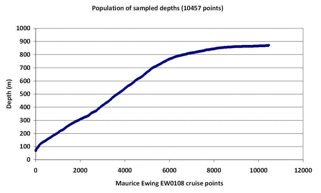
Quality test of this bathymetry: by using the data acquired during the EW0108 expedition of the Maurice Ewing in 2001. Cite: Taylor, B., (2014). Ship-based Trackline Geophysical Data (MGD77) acquired during the Maurice Ewing expedition EW0108 (2001). Interdisciplinary Earth Data Alliance (IEDA). doi:10.1594/IEDA/314812 : Raw batymetry file in ASCII (definition of the MGD77 format is here), and valid points in .csv format here (transformation shell read_mgd77)
Comparison between the Emodnet grid and the survey of the Maurice Ewing: comparison shell compare_emodnet_ew0108; comparison file .csv and .xls (with graphics).
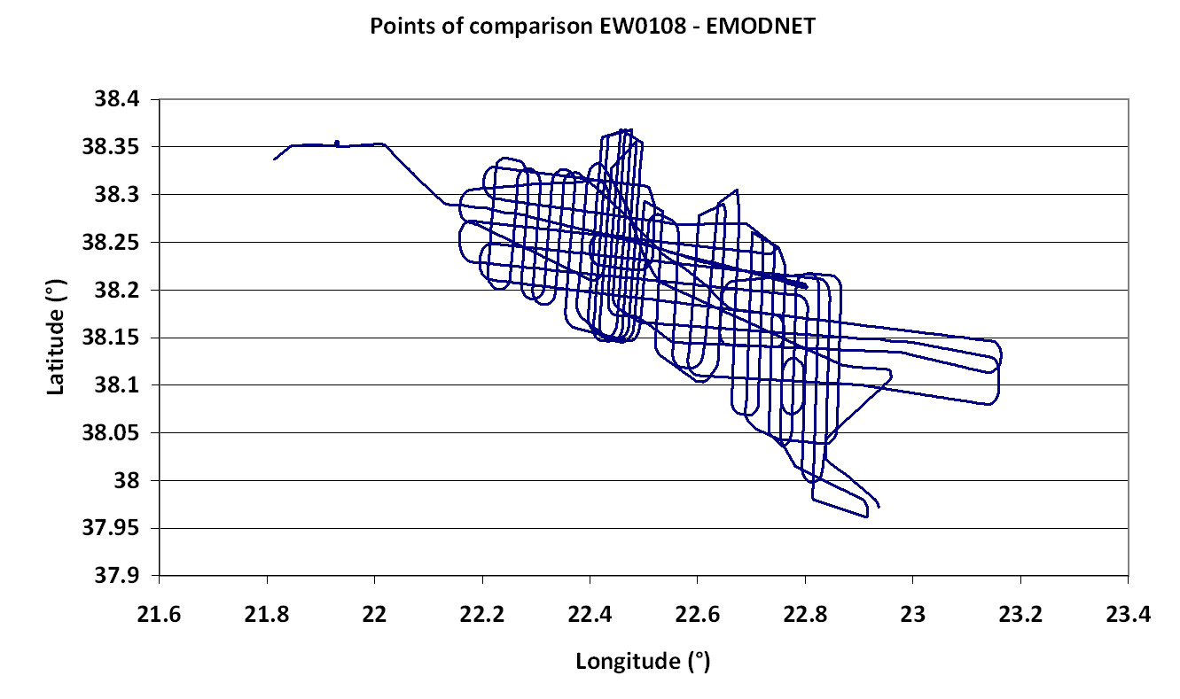

This figure shows, in map, the difference of bathymetry between the two surveys. The red colours to the south and blue-green to the north might be due to a shift of latitude of 50-100 m between the two data files.
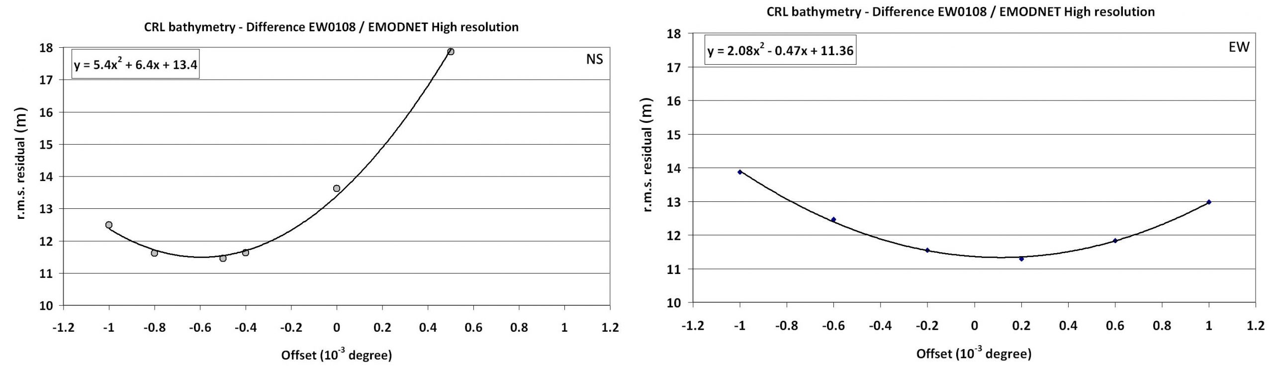
Offset north-south and east-west of the Maurice Ewing points and the EMODNET grid. The offset is -0.000595° in north and 0.000115° in east, i.e. the best fit is obtained by shifting the EMODNET grid by 66 m towards north and 9 m towards west.
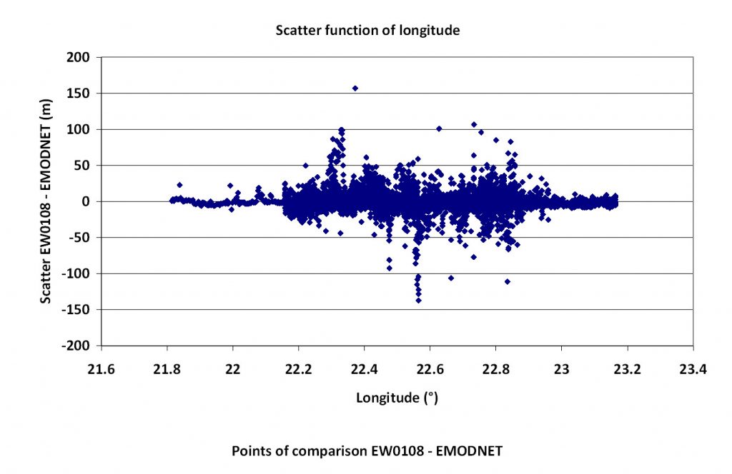
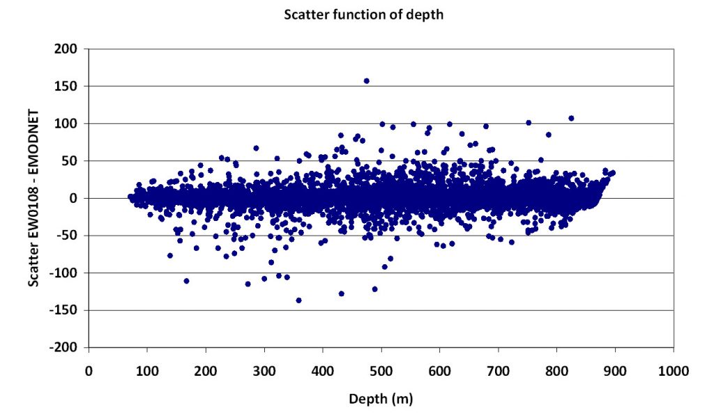
In the vertical the EMODNED gives depths 0.28 m lower that the Maurice Ewing data. The r.m.s. scatter is 11.47 m which is consistent with the standard uncertainty reported by EMODNED of 1 m +0.005 * d (d = depth in metres).