Bibliography
- Note on the modelling of the GNSS data (28/1/2019)
- Cirella A. et al., 2020. The 2018 Mw 6.8 Zakynthos (Ionian Sea, Greece) earthquake: seismic source and local tsunami characterization, GJI, 221, 2, 1043-1054, https://doi.org/10.1093/gji/ggaa053 [pdf]
- Chousianitis K. and Konca A., Intraslab deformation and rupture of the entire subduction crust during the 25 October Mw 6.8 Zakynthos earthquake, GRL, 46, 24, 14358-14367.
- Sokos E. et al., 2020, The 2018 Mw 6.8 Zakynthos, Greece, earthquake: dominant strike-slip faulting near subduction slab, Seismological Research Letters, 91 (2A), 721-732.
Fault location and parameters inferred from the modelling of the displacement at the GPS station
|
Parameter |
Unit |
Co-seismic |
Post-seismic |
|
Long(1) |
° |
20.625 ± 0.01 |
20.625 ± 0.02 |
|
Lat(1) |
° |
37.415 ± 0.01 |
37.415 ± 0.02 |
|
Depth |
km |
3 ± 1 |
0 ± 1 |
|
Length |
km |
26 ± 3 |
26 ± 6 |
|
Width |
km |
16.5 ± 2 |
3 ± 2 |
|
Strike |
° |
9 ± 6 |
9 ± 25 |
|
Dip |
° |
25 ± 5 |
90 ± 40 |
|
Rake |
° |
170 ± 6 |
180 ± 25 |
|
Slip |
m |
1.93 ± 0.1 |
1.9 ± 0.5 |
|
Moment |
N m |
2.73 1019 |
0.44 1019 |
|
Centroid |
km |
6.5 |
1.5 |
Parameters of the fault in the « inverse6 » format: zaky7.fai
Model of tsunami calculated with CLIONA (©CEA/DASE) (processing of 2020/03/02) by Simon Bufféral using the above parameters for the fault
Animation with input parameters « model7 » (above) – see GIF
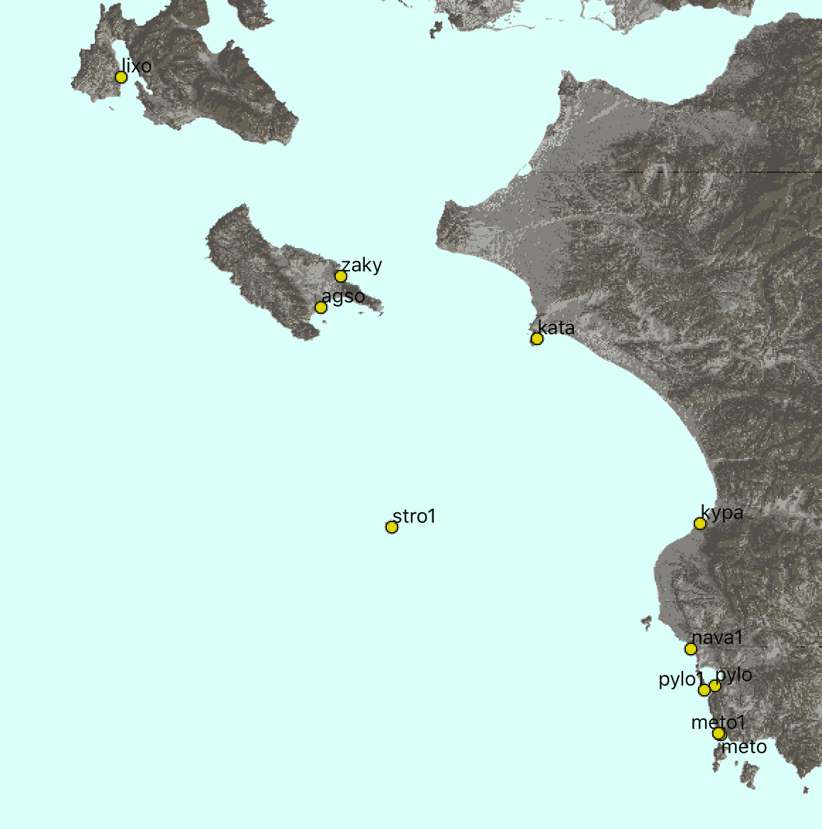
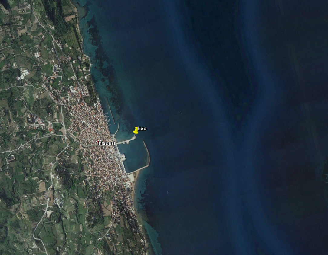
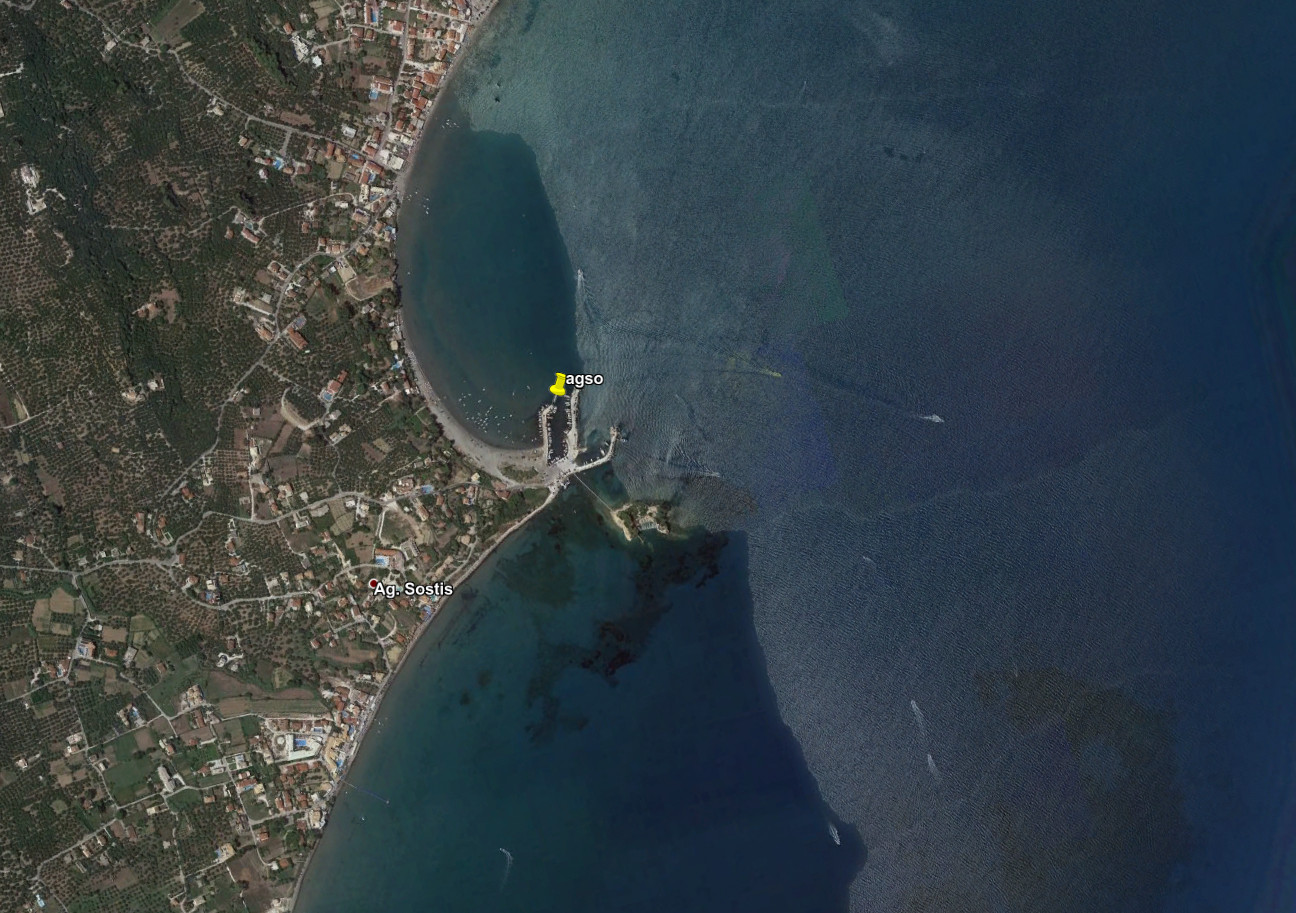
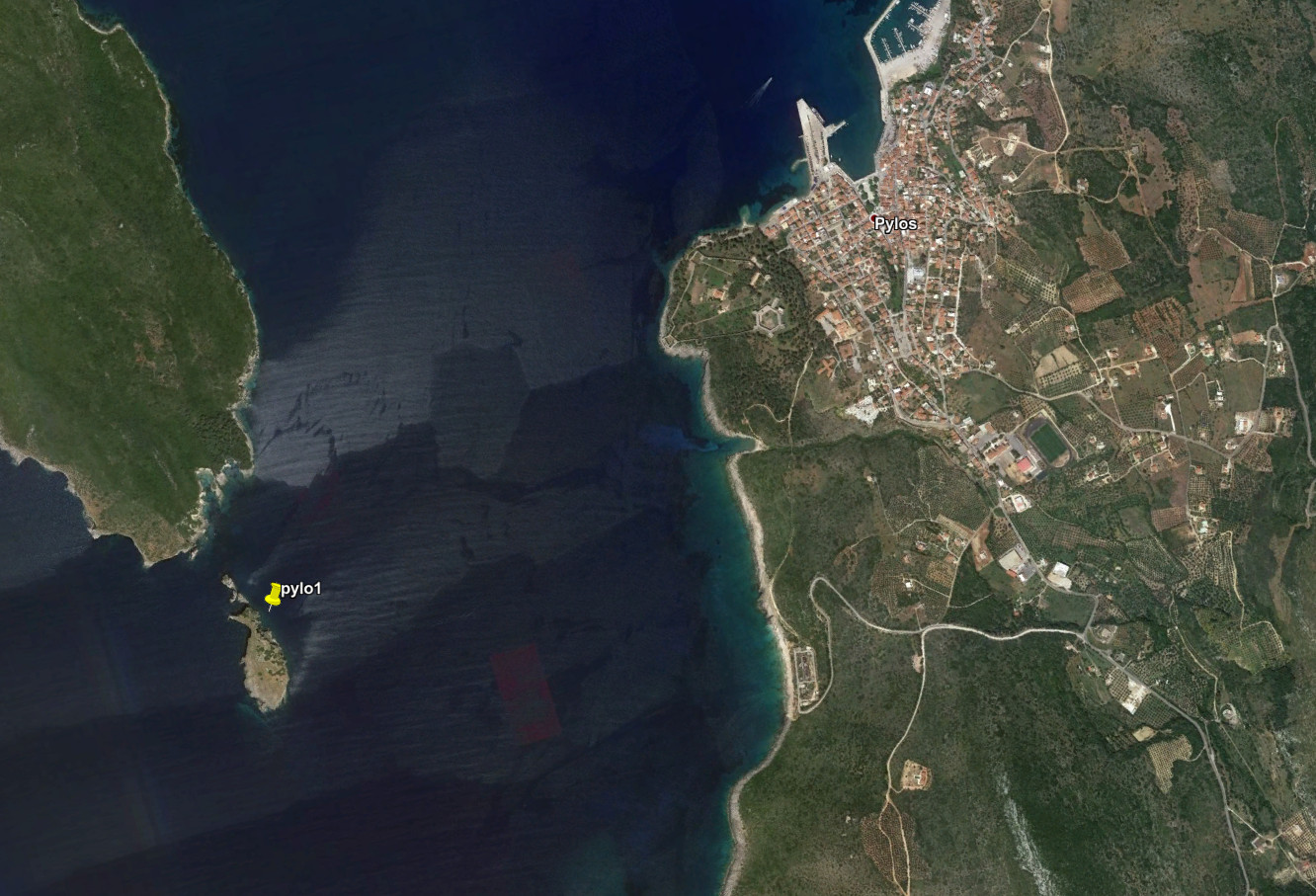
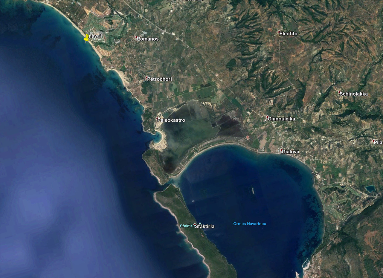
Location of the real and theorical tide gauges

Location of the real (R) or theoretical (T) tide gauges
| Code | Status | East | North | Note |
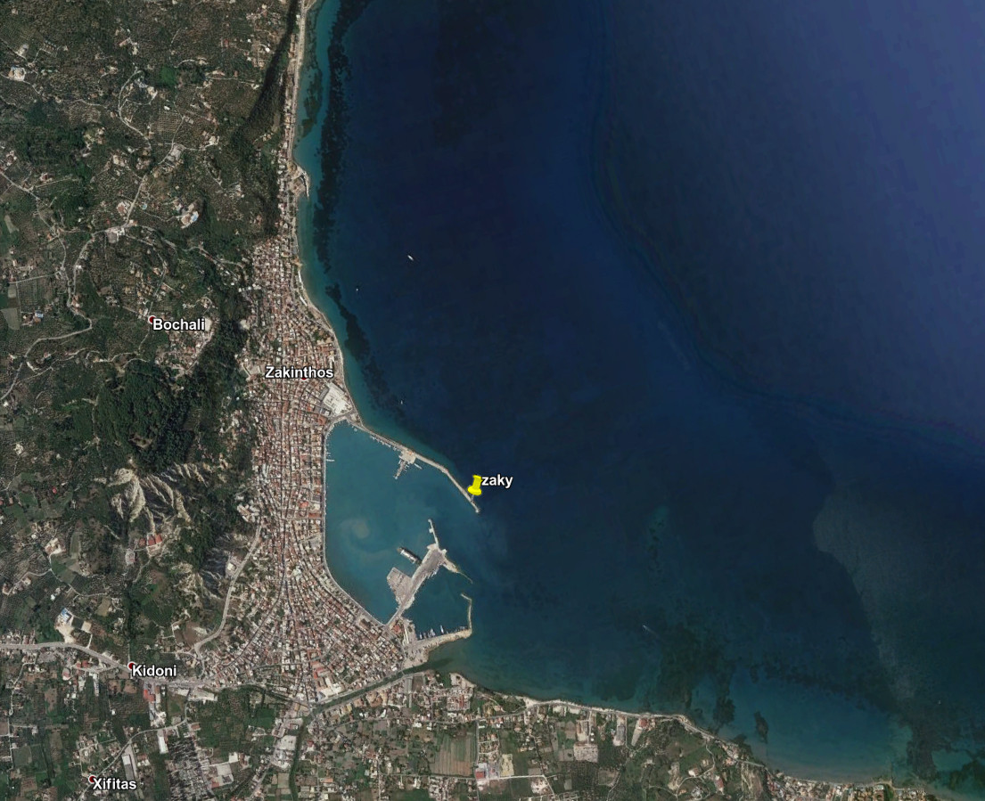
| zaky | T | 20.90524 | 37.78163 | Entrance of the harbour of Zakynthos |
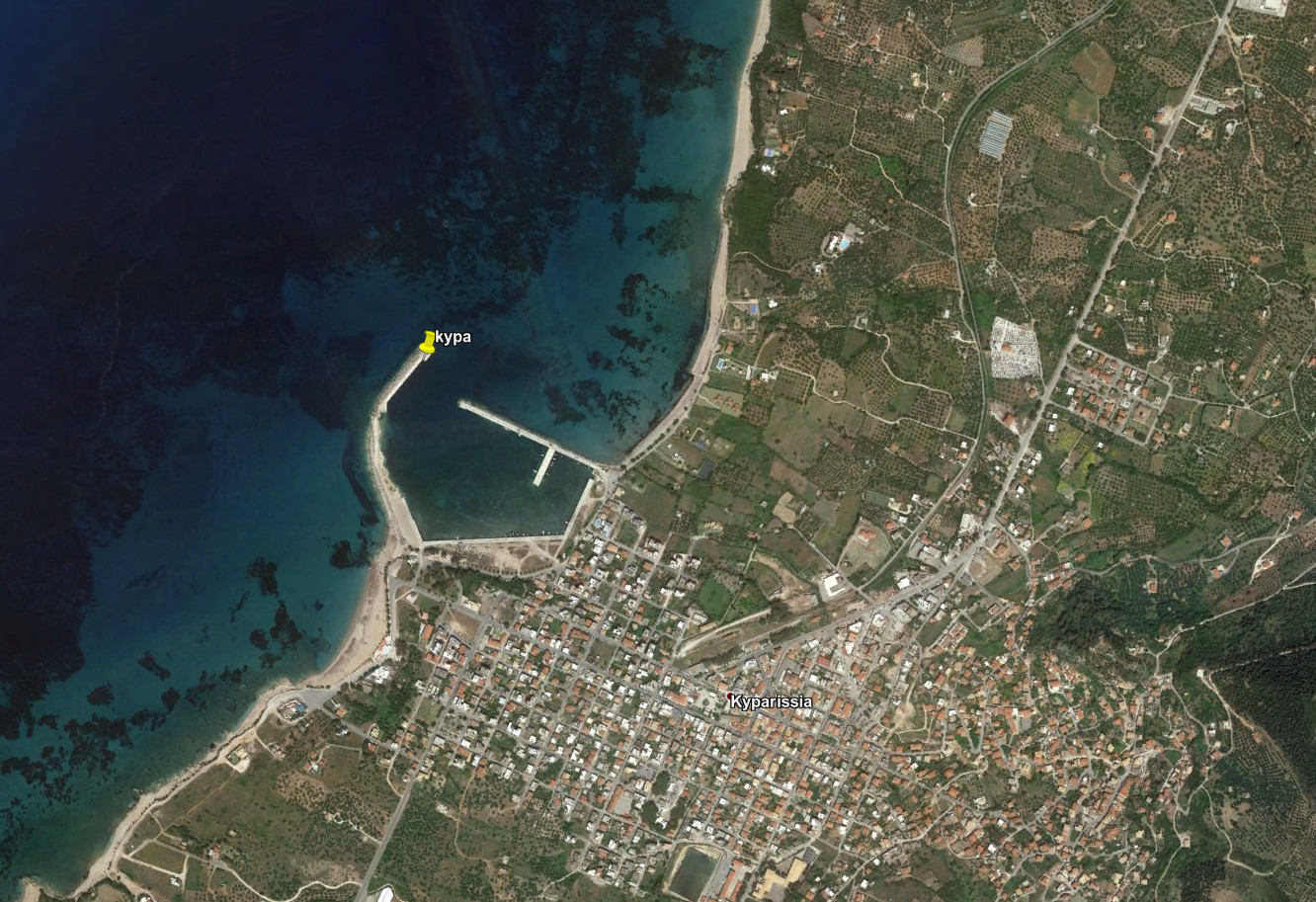
| kypa | R | 21.66434 | 37.25933 | |
| lixo | T | 20.44213 | 38.20181 | Harbour of Lixourion |
| pylo | T | 21.69489 | 36.91665 | Harbour of Pylos |
| agso | T | 20.86407 | 37.71599 | Harbour of Agios Sostis |
| kata | R | 21.32052 | 37.64904 | |
| pylo1 | T | 21.67329 | 36.90737 | Island and the entrance of the Pylos bay |
| nava1 | T | 21.64530 | 36.99514 | Assumed a buoy 50m in front of the Navarino Environmental Observatory |
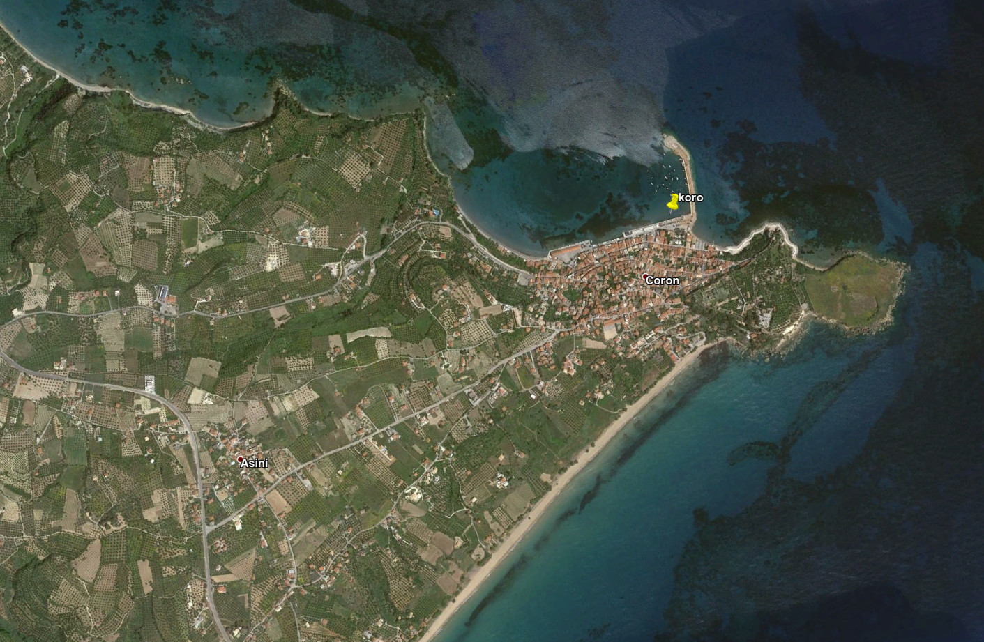
| koro | T | 21.95986 | 36.79756 | Harbour of Koroni |
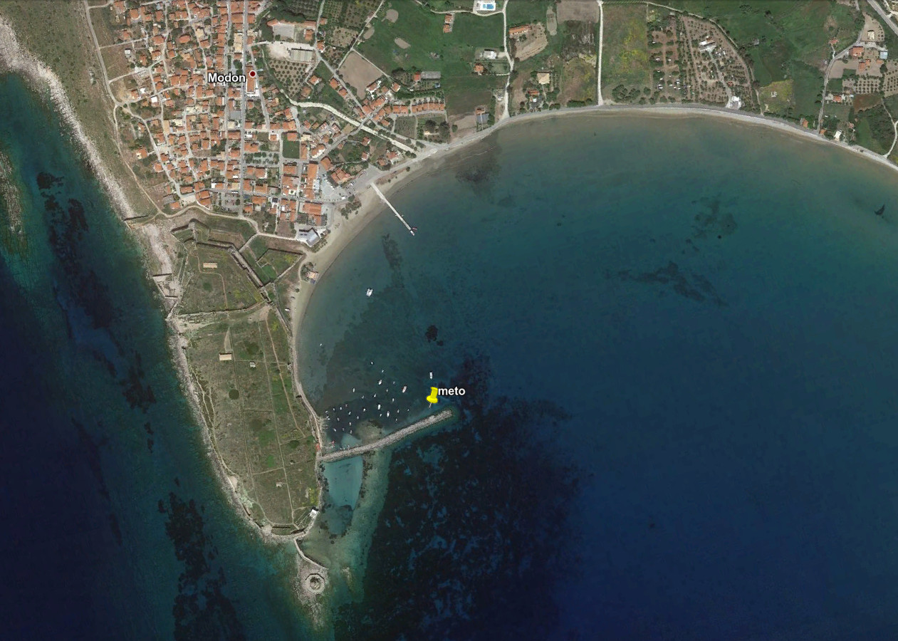
| meto | R | 21.70786 | 36.81402 | Harbour of Methono |
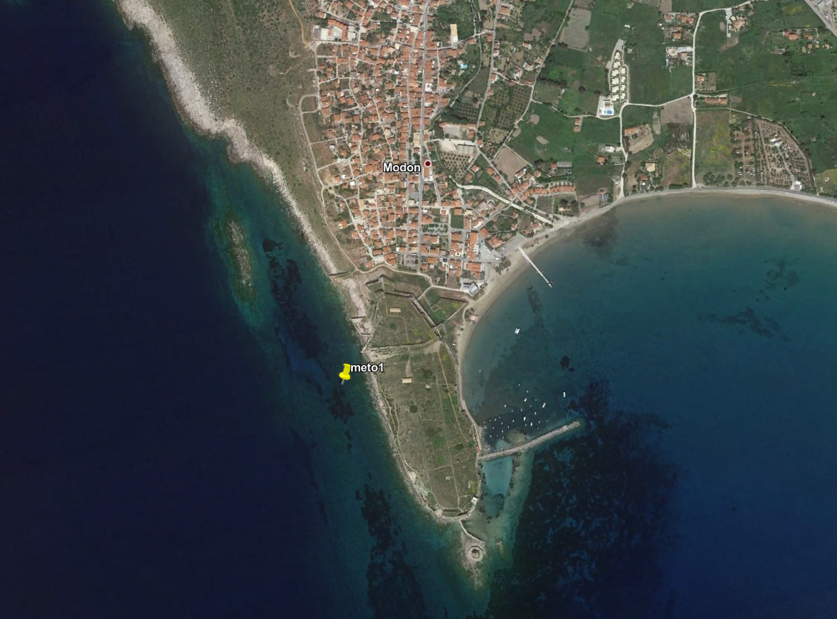
| meto1 | T | 21.70259 | 36.81597 | West of the fortress of Methoni, 50m off-shore (assumed to be a buoy) |
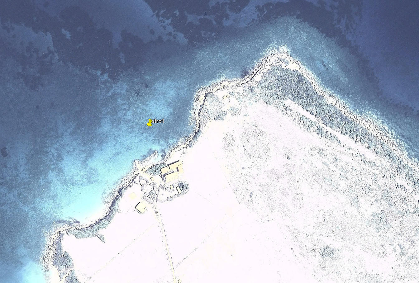
| stro1 | T | 21.01383 | 37.25121 | Strofades, assumed a buoy 50m off-shore in front of the chapel |
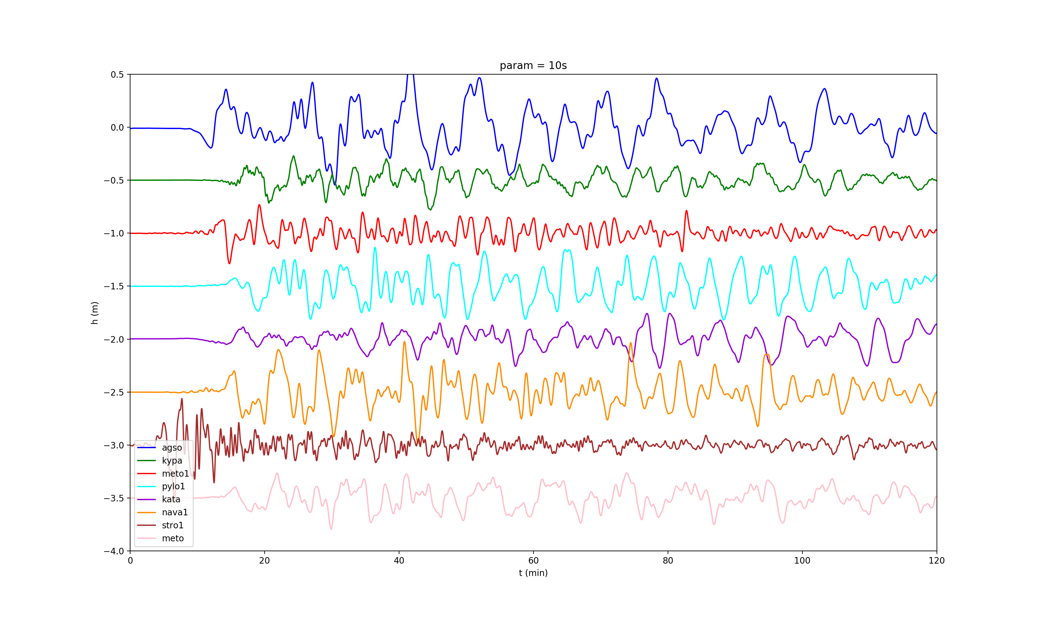
Modelled waves using the « model7 » (here the calculation is made for 7200 seconds (two hours) after the rupture assummed to be at 22:54:51.5 UTC according to the EMSC.
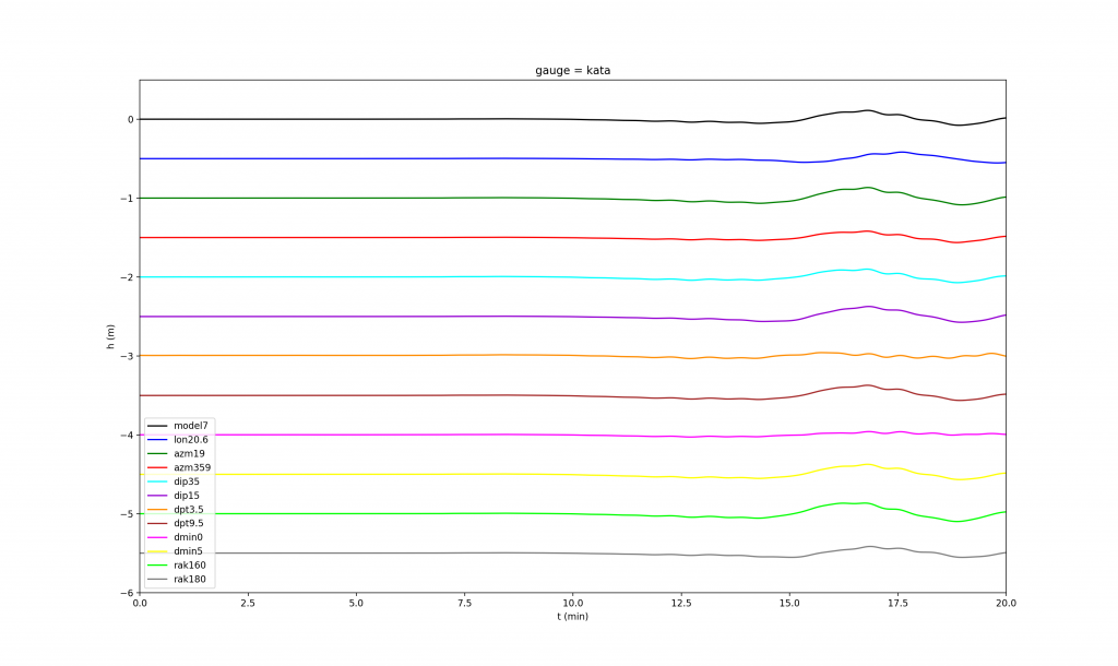
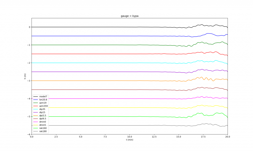
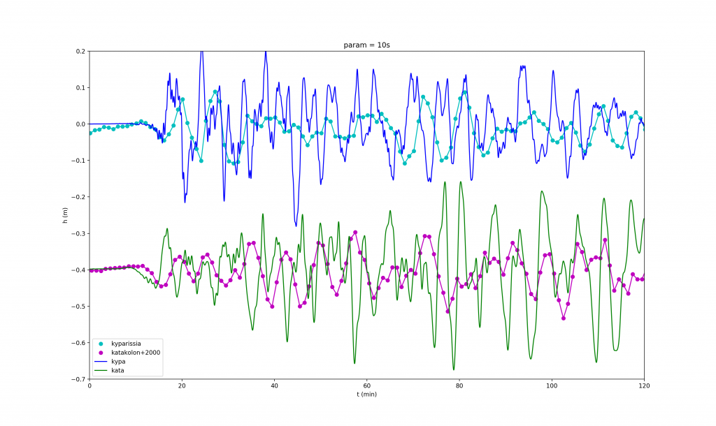
Fit of the data acquired at KATA and KYPA
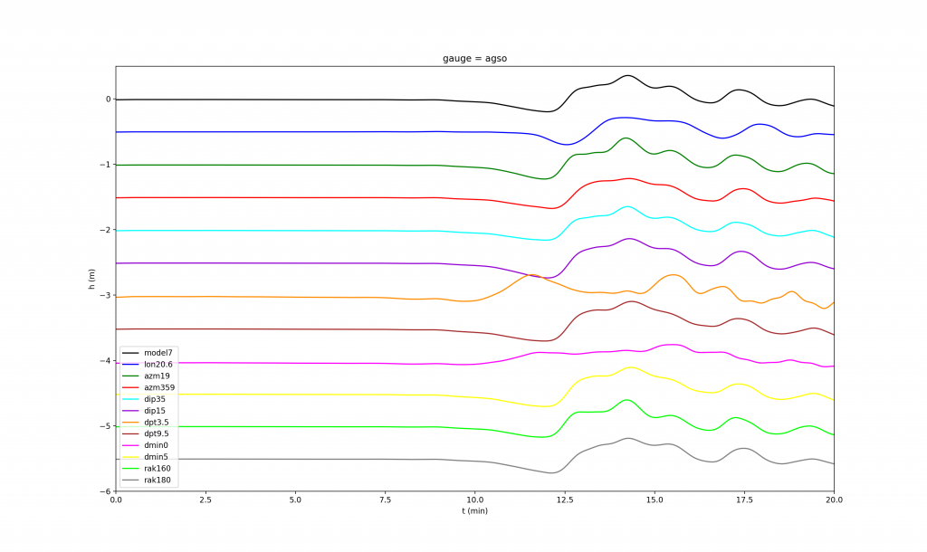
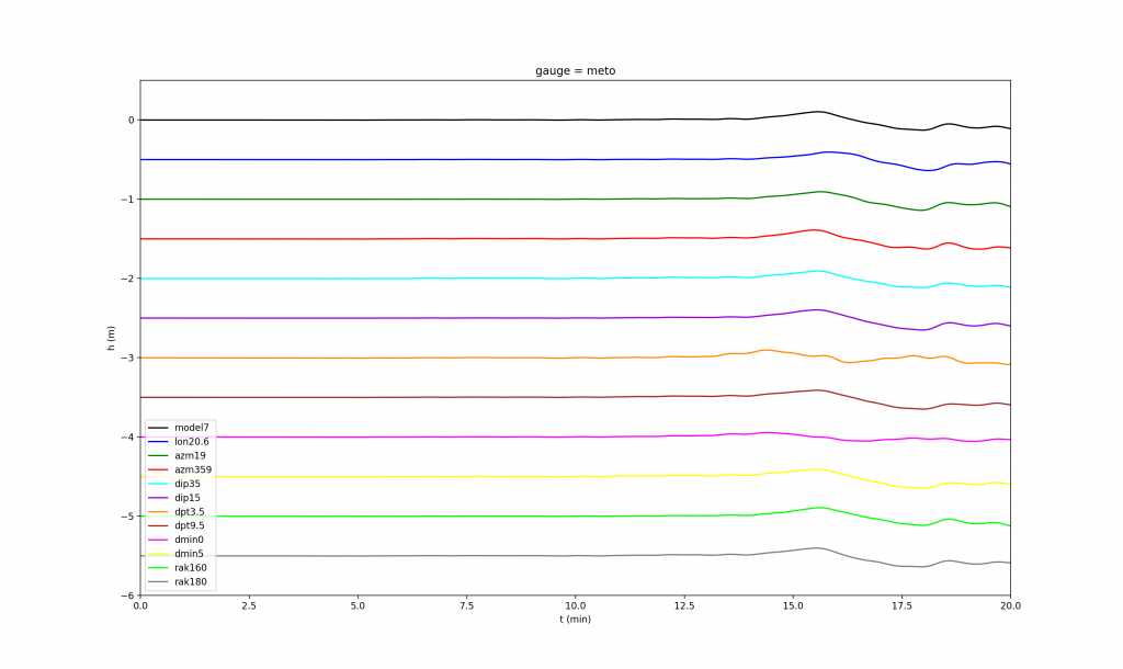
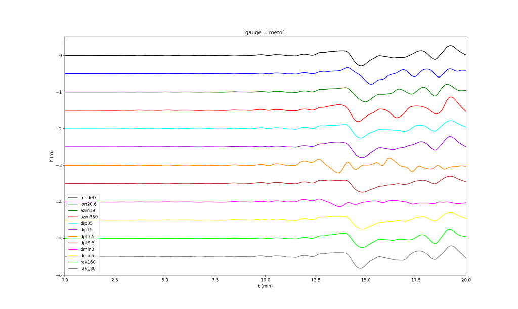
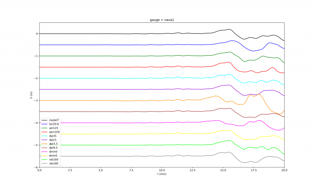
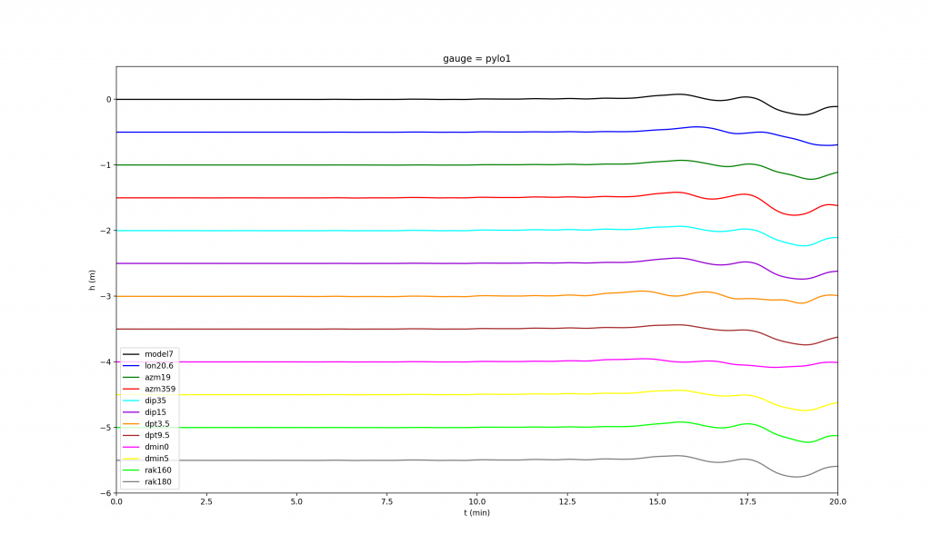
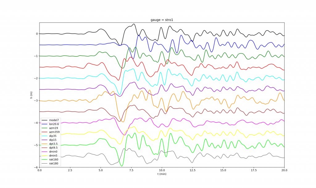
Parametric analysis
At the sites AGSO, KATA, KYPA, METO, METO1, NAVA1, PYLO1, STRO1 we analyzed the perturbations of the model7 induced by changes of the the following parameters:
- longitude (long): nominal 20.71°, tested 20.60°
- model7 – azimuth (azm): nominal 9°, tested : 19° and 359°
- model7 – dip angle (dip): nominal 25°, tested : 15° and 35°
- model7 – depth of centroid (depth): nominal 6.5 km, tested 3.5 km and 9.5 km
- model7 – depth of upper edge of the fault (dmin): nominal 3 km, tested 0 km and 6 km
- model7 – rake (rak): nominal 170°, tested 160° and 180°