- Earthquake catalogs are based on automatic detection and picking. Magnitudes Mw and Ml are also computed automaticaly. Locations are calculated in the 1D velocity model of Rigo et al. (1996) using hypo71 location code. Mw and Ml are calculated using SourceSpec (Satriano, 2020)
Rigo, A., H. Lyon-Caen, R. Armijo, A. Deschamps, D. Hatzfeld, K. Makropoulos, P. Papadimitriou, and I. Kassaras (1996), A microseismic study in the western part of the Gulf of Corinth (Greece) : Implications for large-scale normal faulting mechanisms, Geophys. J. Int., v. 126(3), pp. 663-688.
Satriano, C. (2020) SourceSpec-Earthquake source parameters from S-wave displacement spectra. DOI: 10.5281/ZENODO.3688587
- Format of catalogs is as follows: year, month, day, hour, minute, seconds, latitute, longitude, depth, Mw, Ml, erx, ery, erz, rms, number of P phases, number of S phases, quality (according to hypo71)
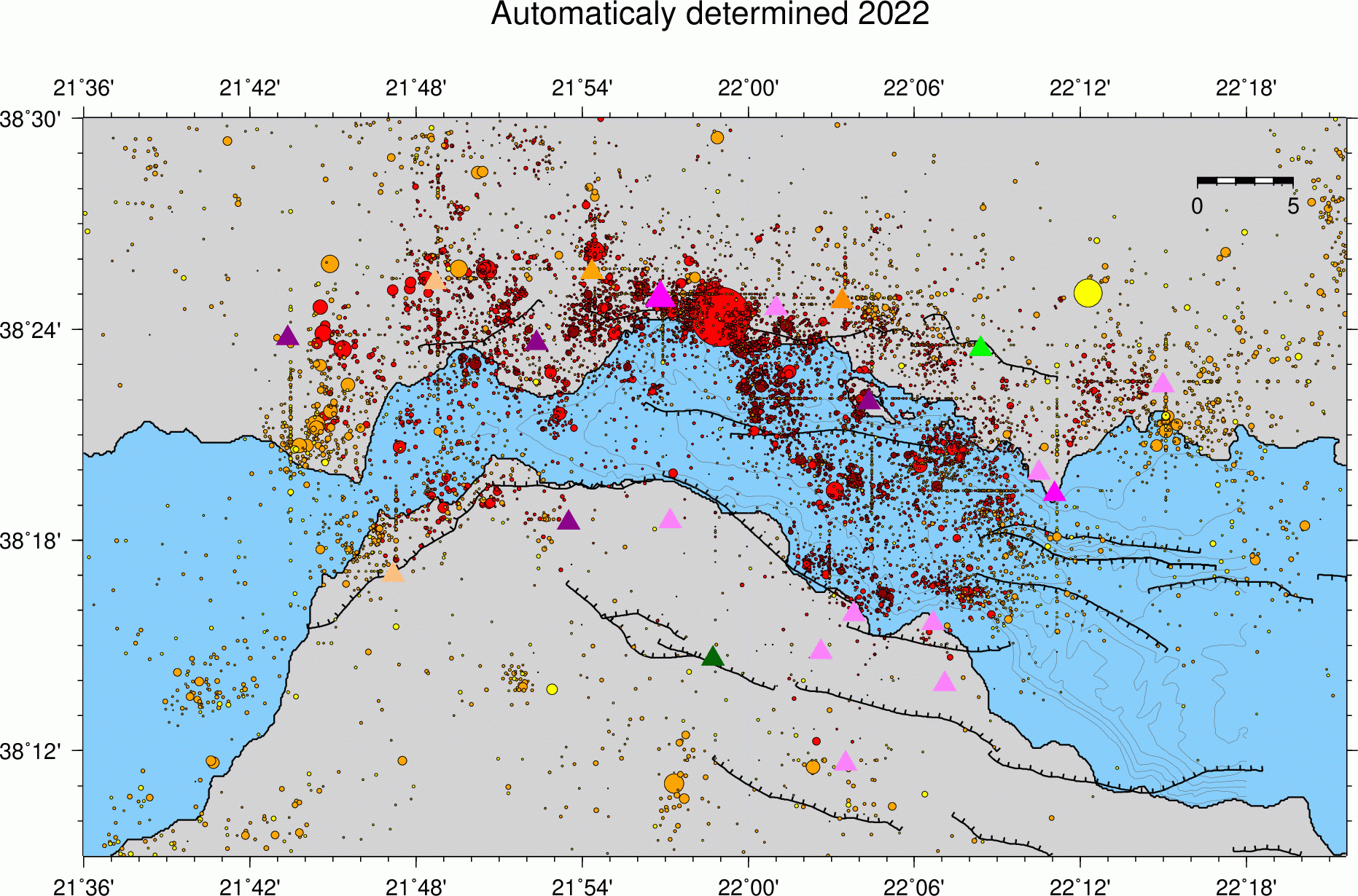
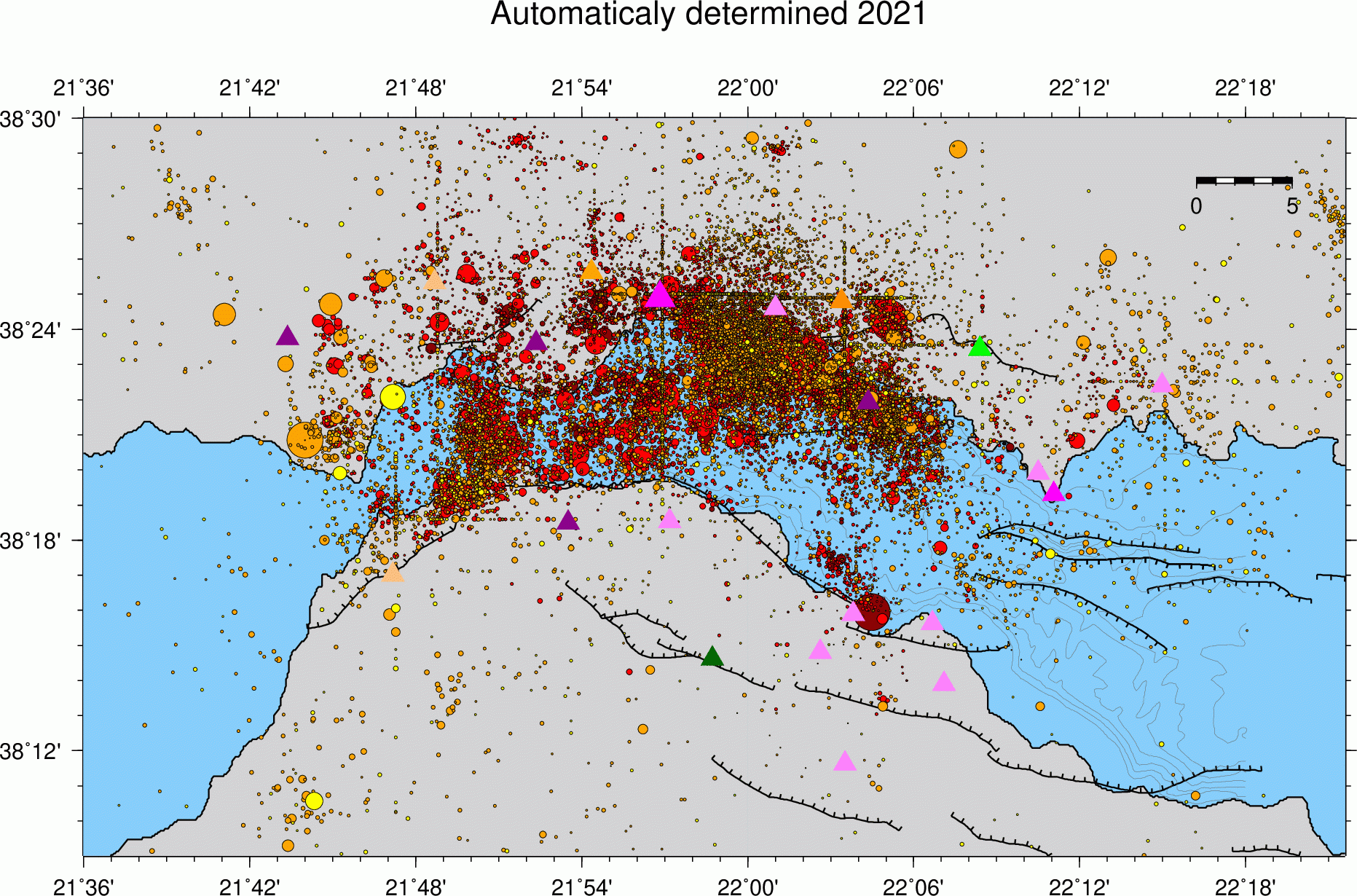
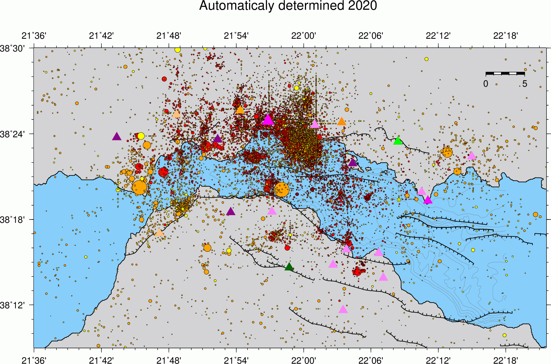
- Seismicity maps: quality A events (best ones) are in dark red, quality B in red, quality C in orange and quality D (low reliability) in yellow... Size is proportional to seismic moment.

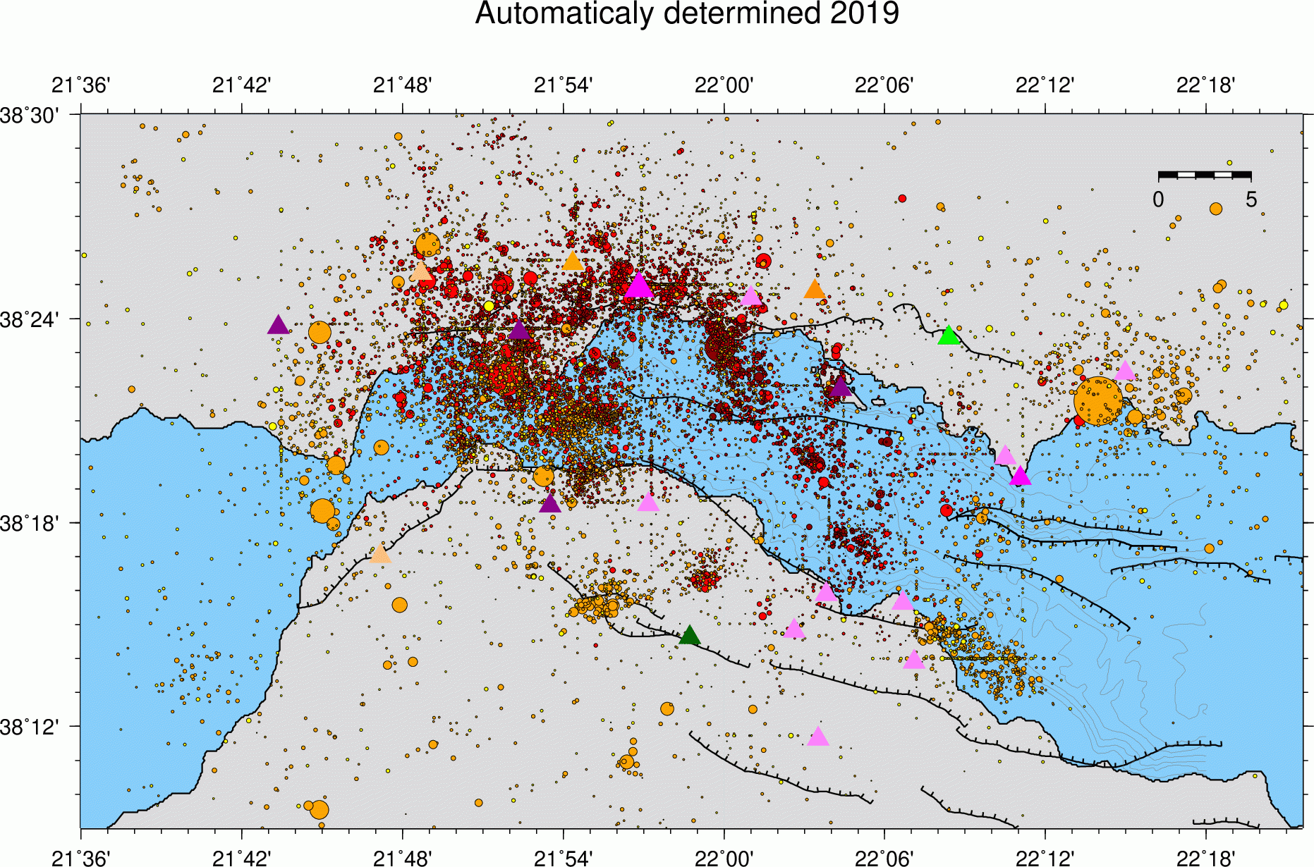
Seismicity 2019 (cat_2019_Mw)
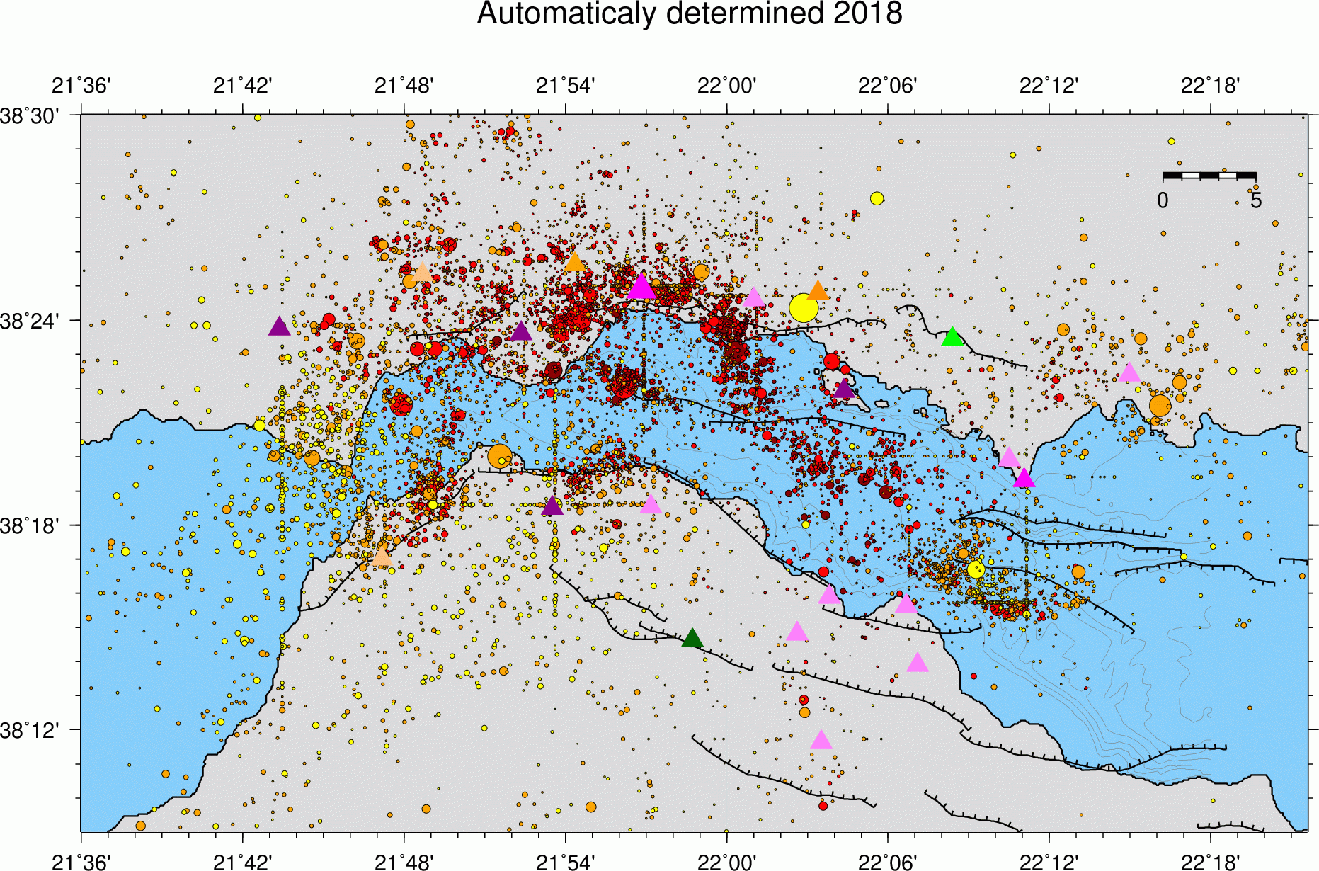
Seismicity 2018 (cat_2018_Mw)
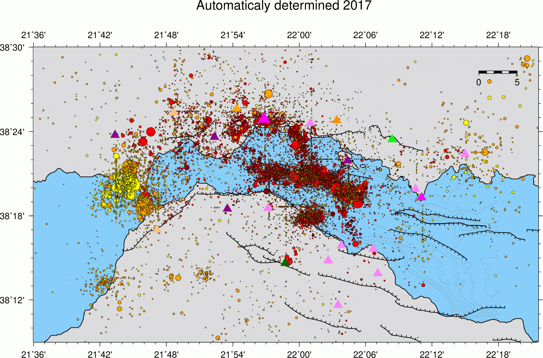
Seismicity 2017 (cat_2017_Mw)

Seismicity 2016 ( cat_2016_Mw)
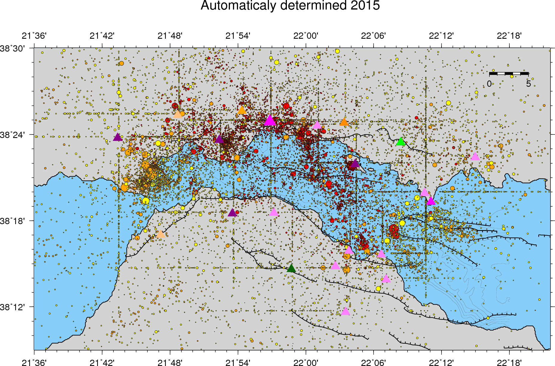 Seismicity 2015 (cat_2015_Mw)
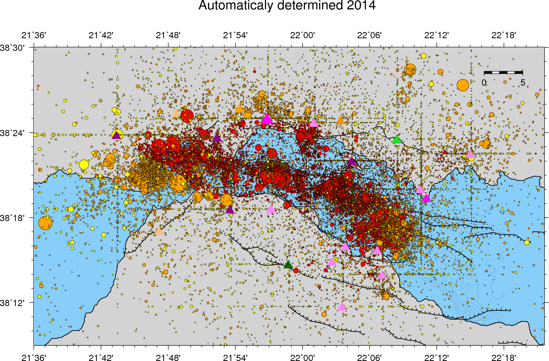 Seismicity 2014 (cat_2014_Mw)
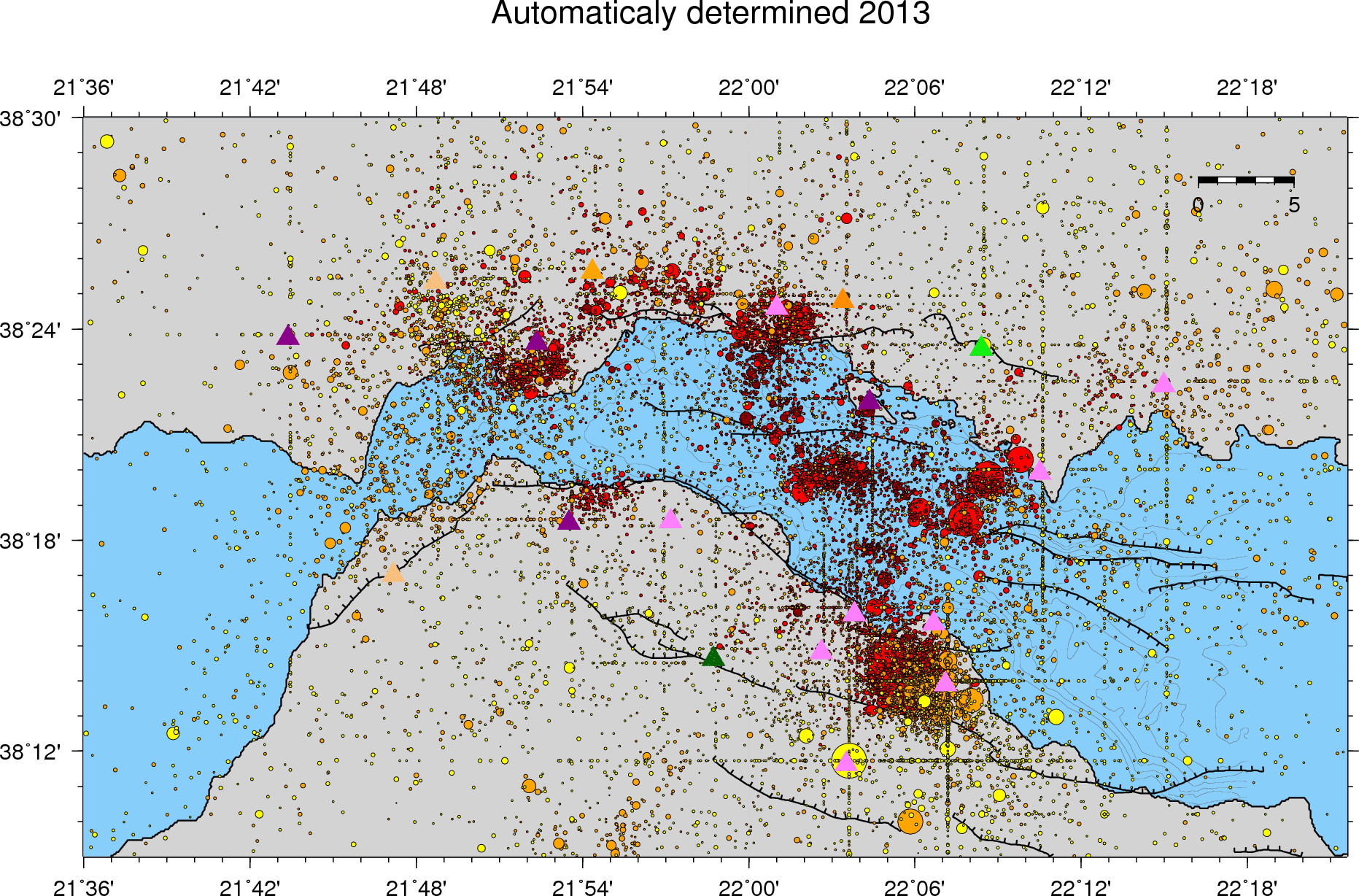 Seismicity 2013 (cat_2013_Mw)
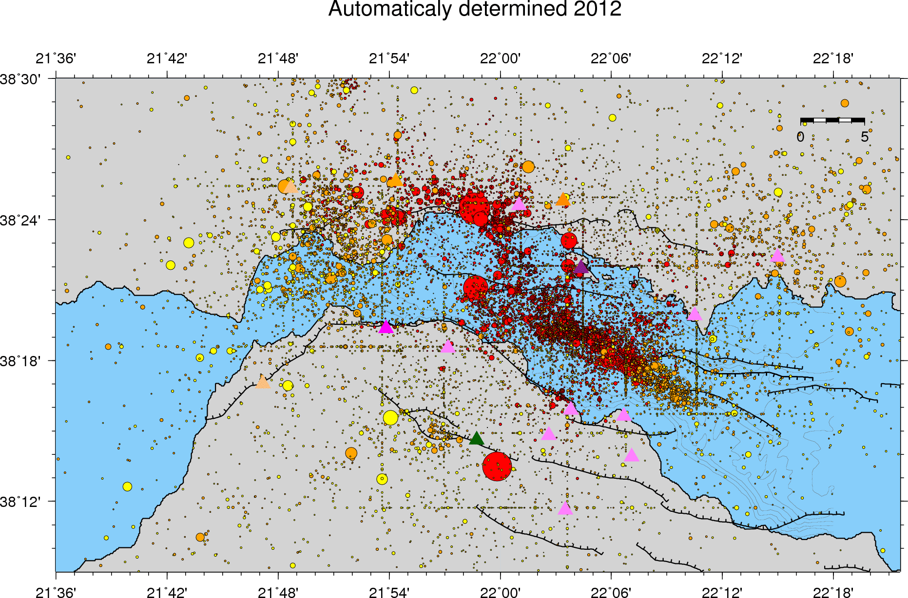 Seismicity 2012 (cat_2012_Mw)
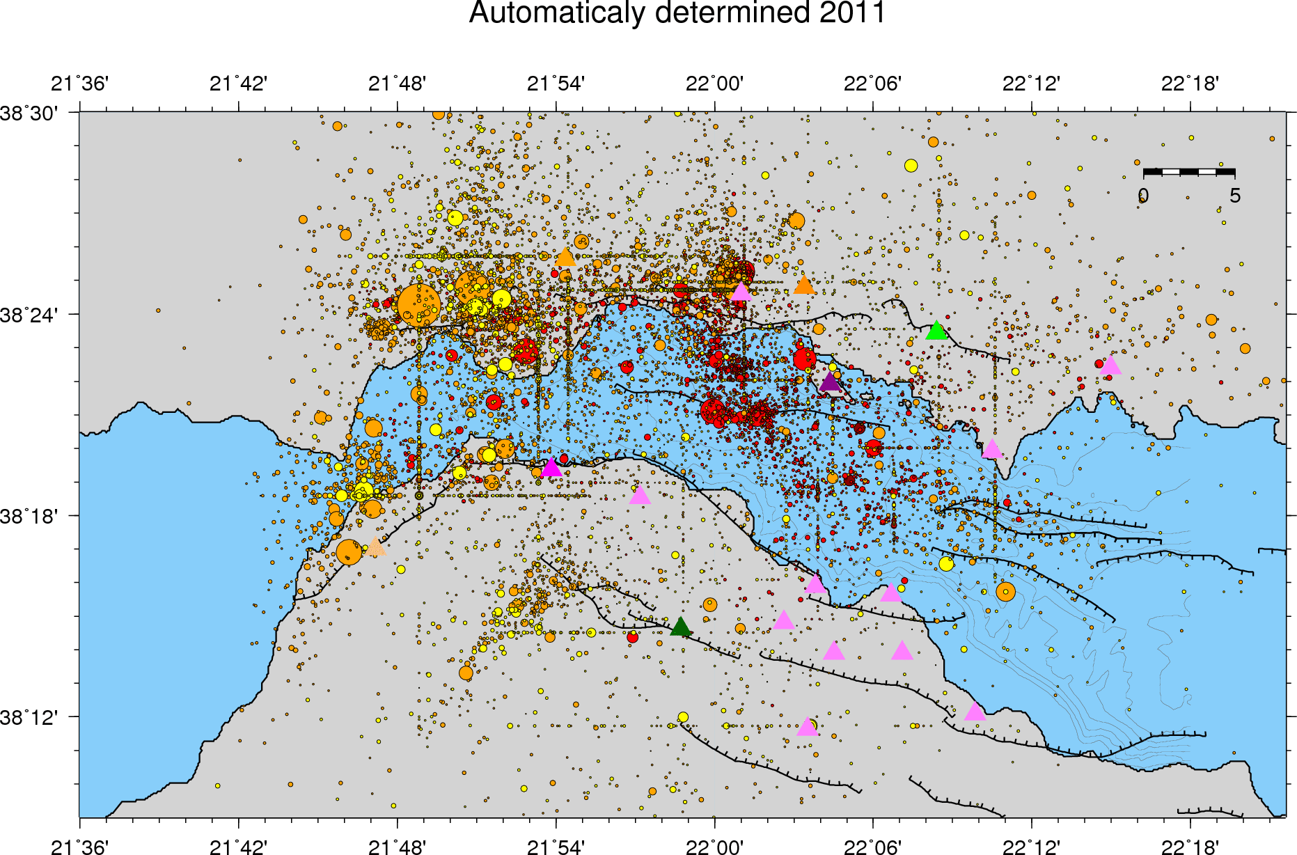 Seismicity 2011 (cat_2011_Mw)
 Seismicity 2010 (cat_2010_Mw)
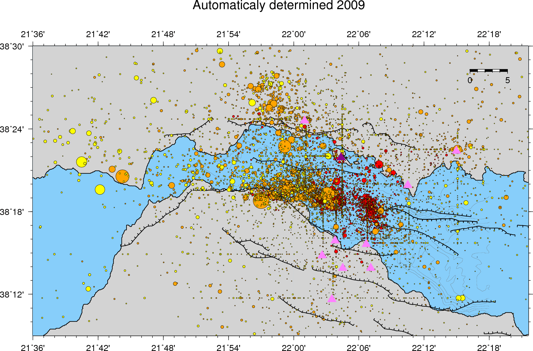 Seismicity 2009 (cat_2009_Mw)
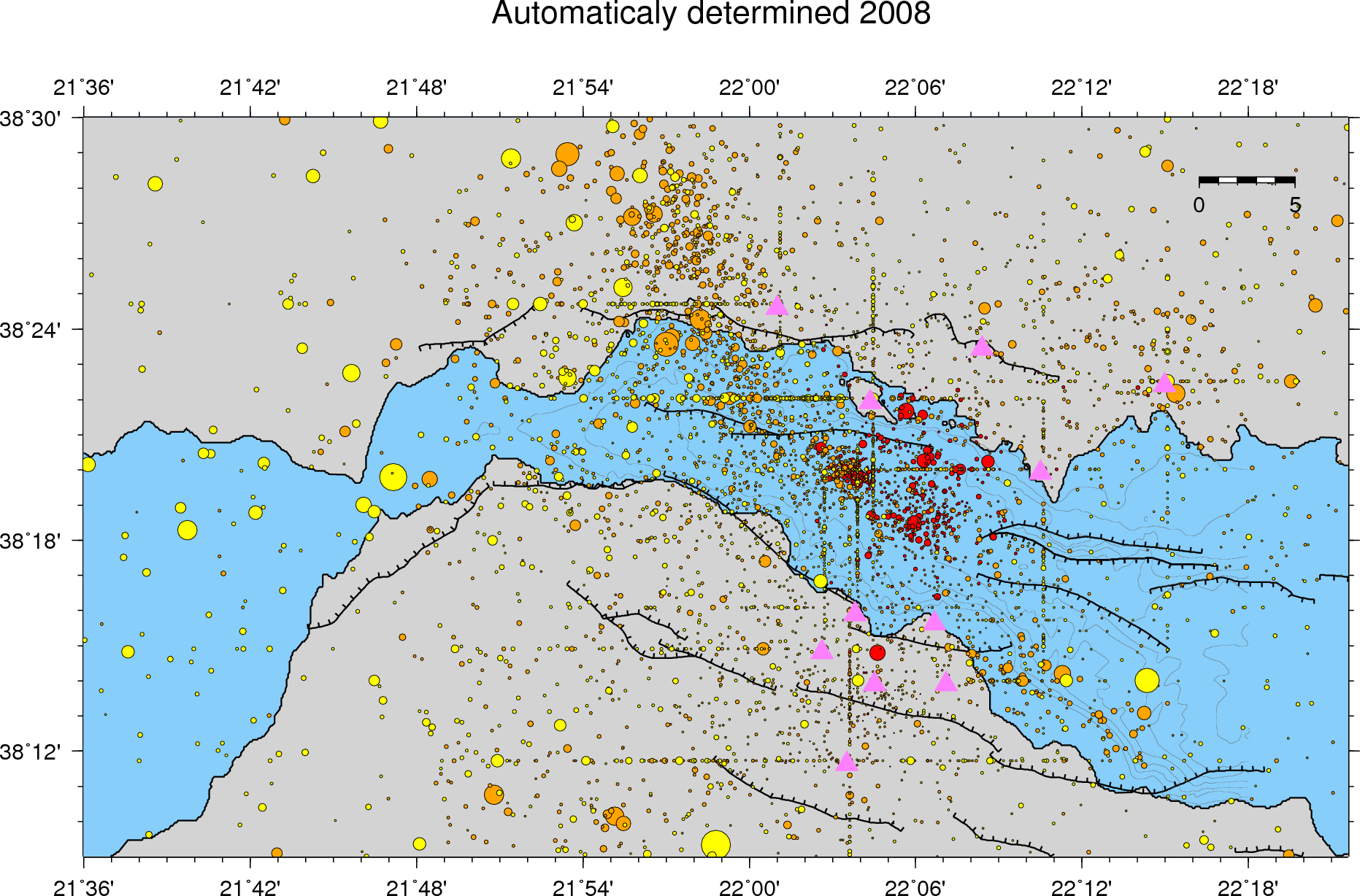 Seismicity 2008 (cat_2008_Mw)
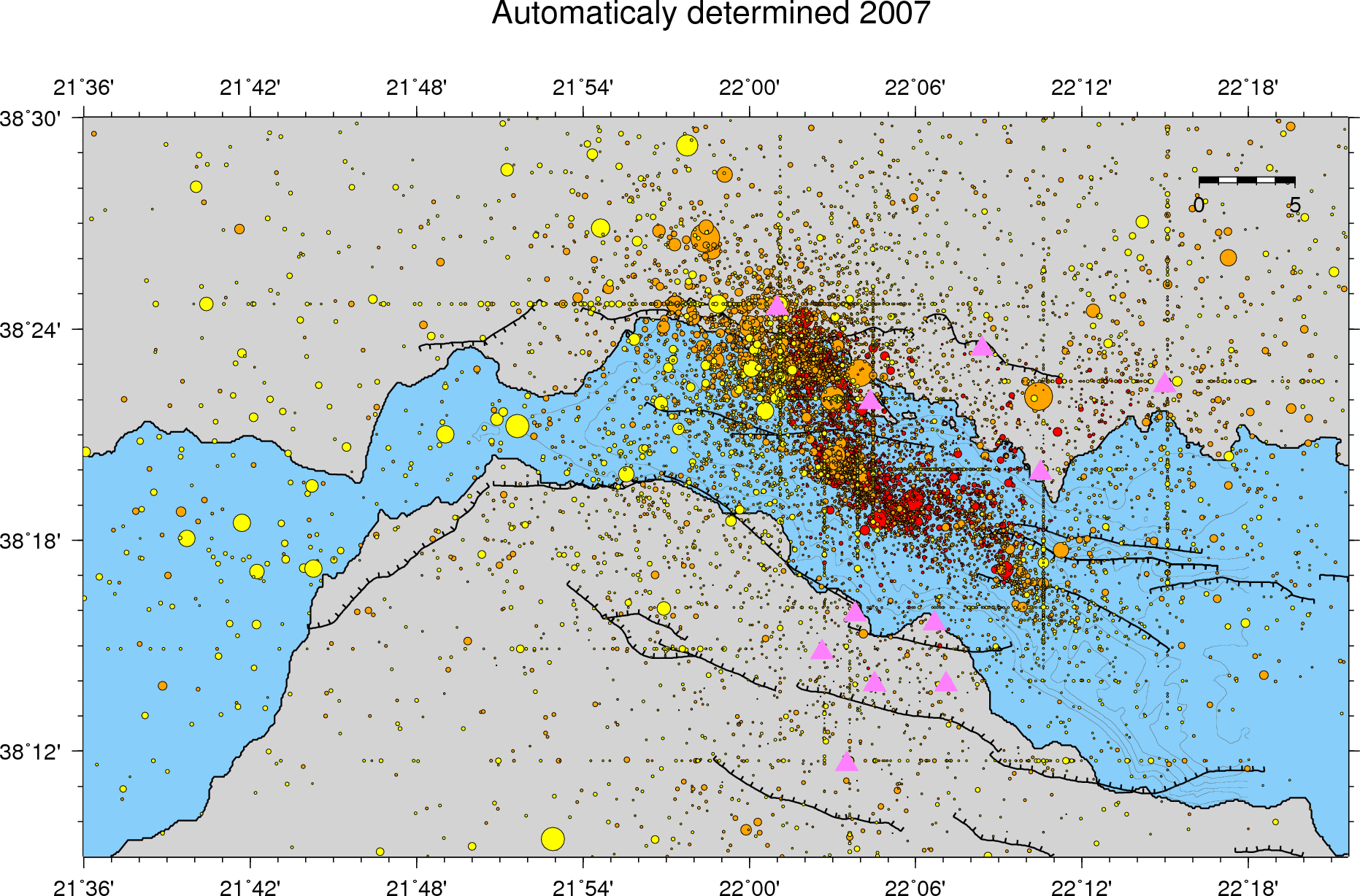 Seismicity 2007 (cat_2007_Mw)
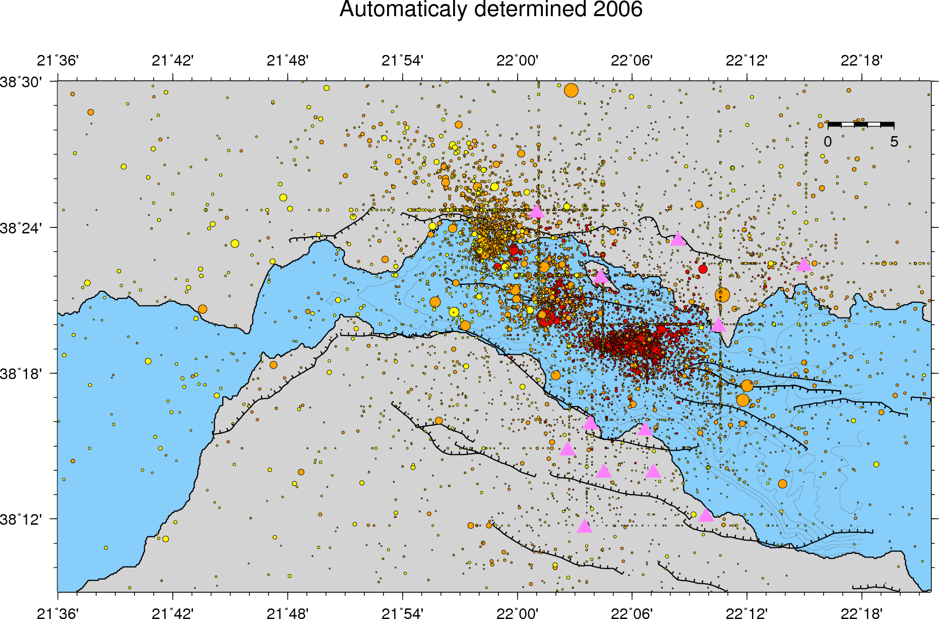 Seismicity 2006 (cat_2006_Mw)
 Seismicity 2005 (cat_2005_Mw)
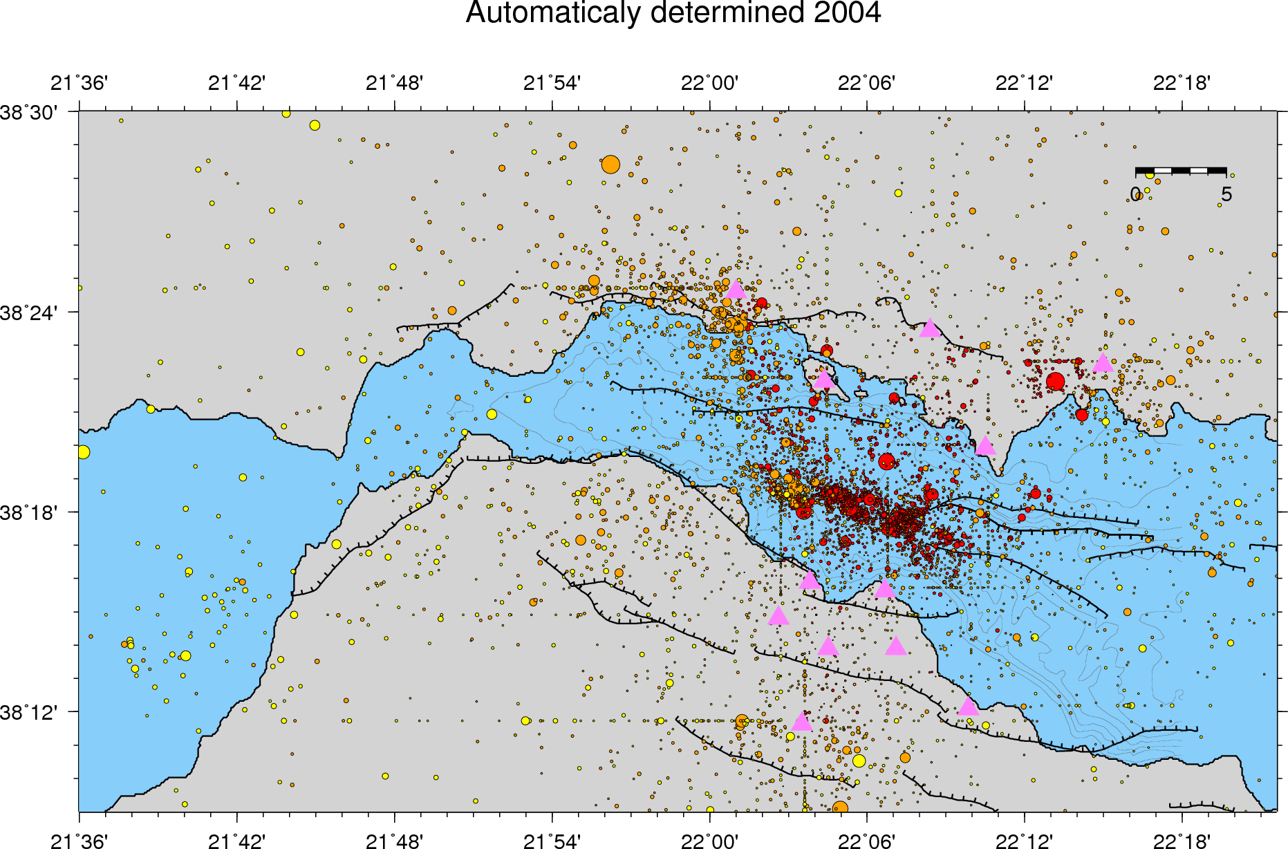 Seismicity 2004 (cat_2004_Mw)
 Seismicity 2003 (cat_2003_Mw)
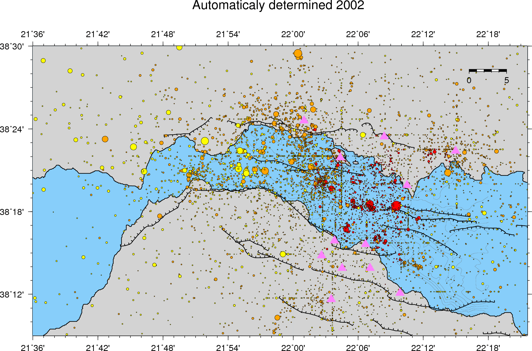 Seismicity 2002 (cat_2002_Mw)
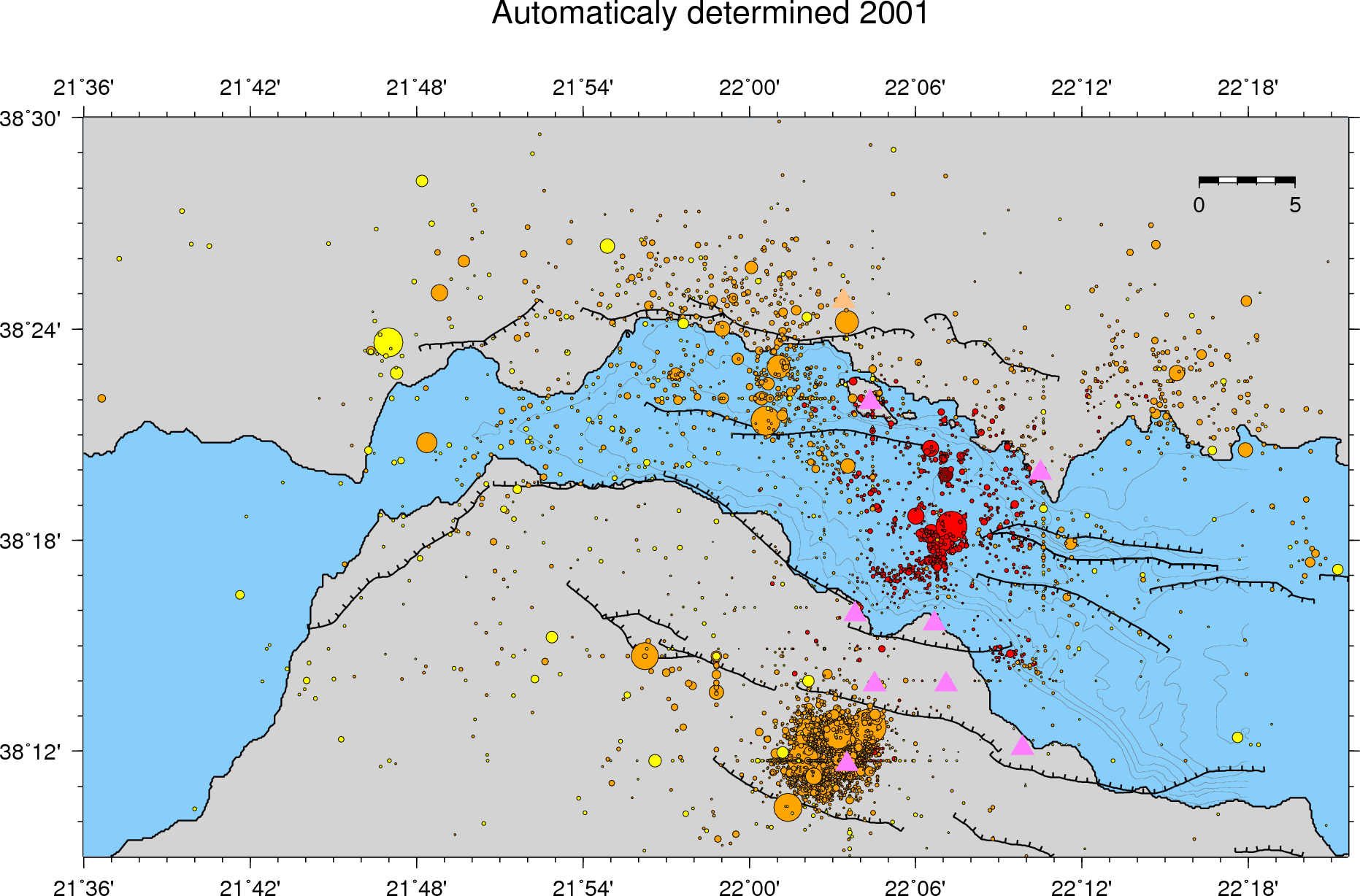 Seismicity 2001 (cat_2001_Mw)
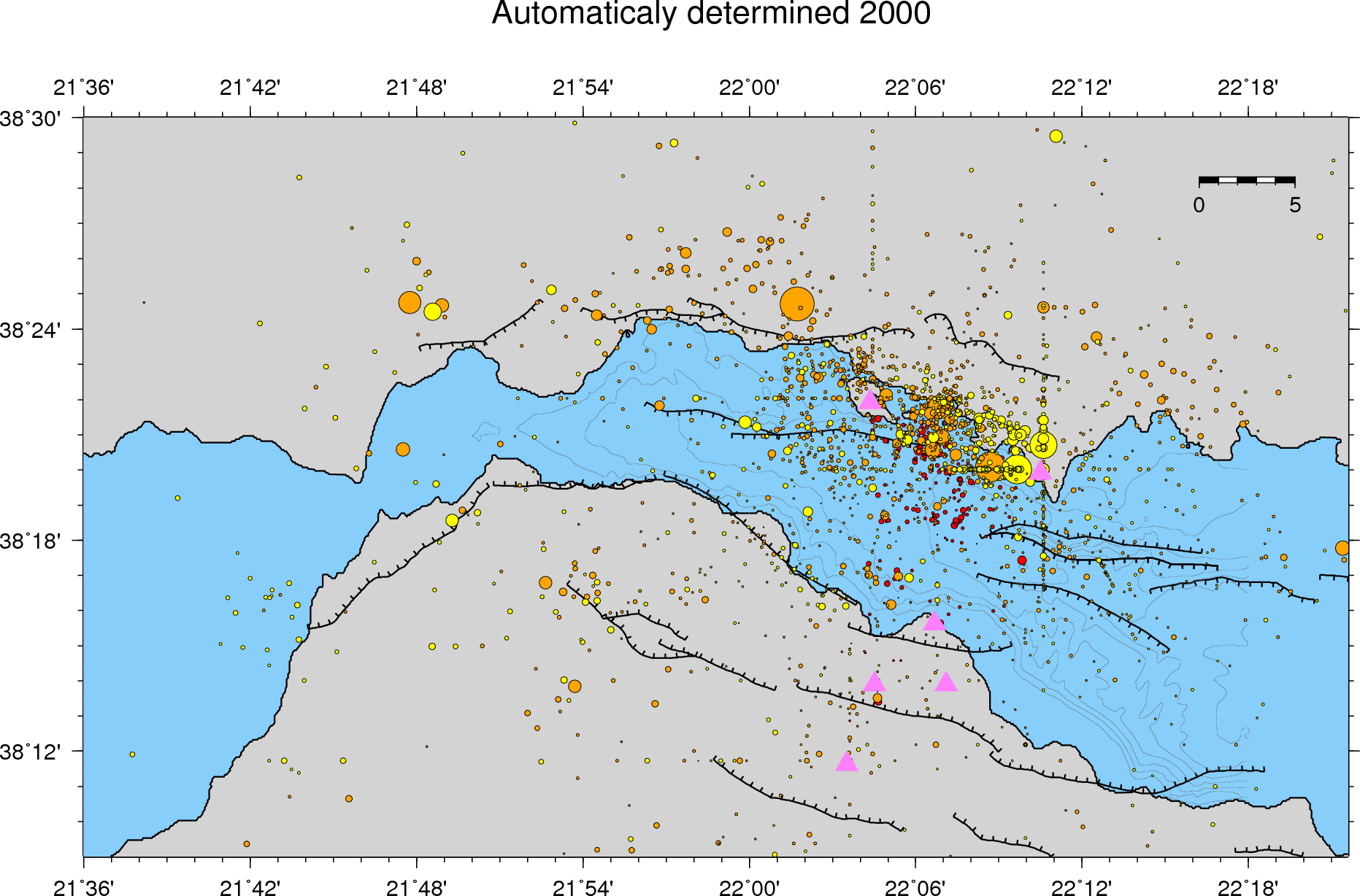 Seismicity 2000 (cat_2000_Mw)
Nota: instruction to transform initial .ps images: convert -density 200 map_2016_Mw.ps -trim -background white +repage -flatten map_2016_Mw.gif