Catégorie : InSAR
InSAR velocities
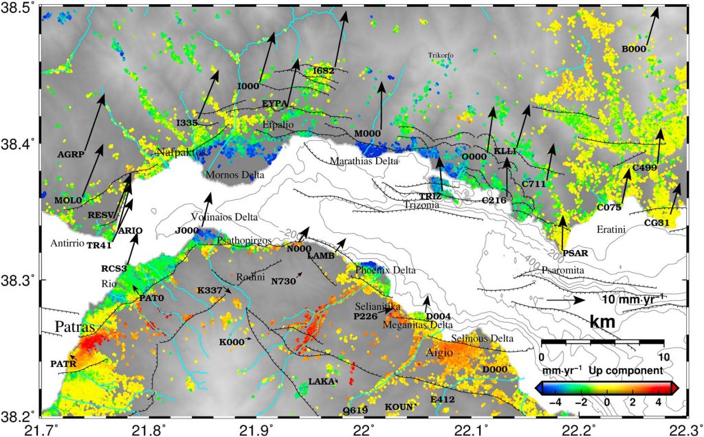
Ground Vertical and east Velocities for the Western Gulf of Corinth, Greece, combining InSAR and GPS
Ground Vertical and east Velocities for the Western Gulf of Corinth, Greece, combining InSAR and GPS. The vertical and east-west ground deformation velocities of different resolution and precision using 70 ASAR/ENVISAT acquisitions between 2002-2010 and velocities from 73 GNSS points are available to be downloaded.
Interferograms
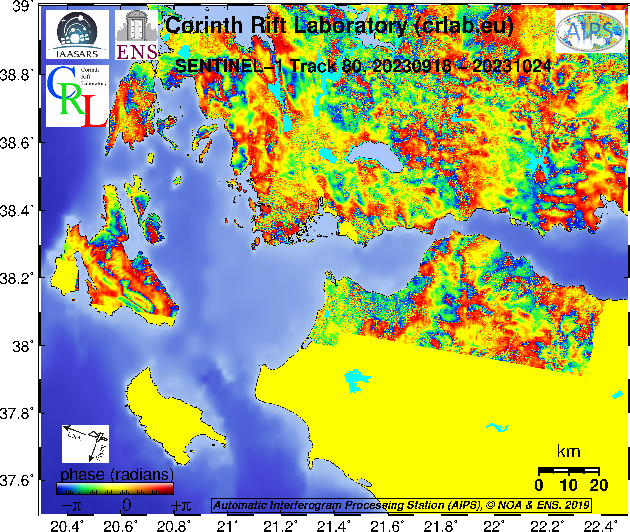
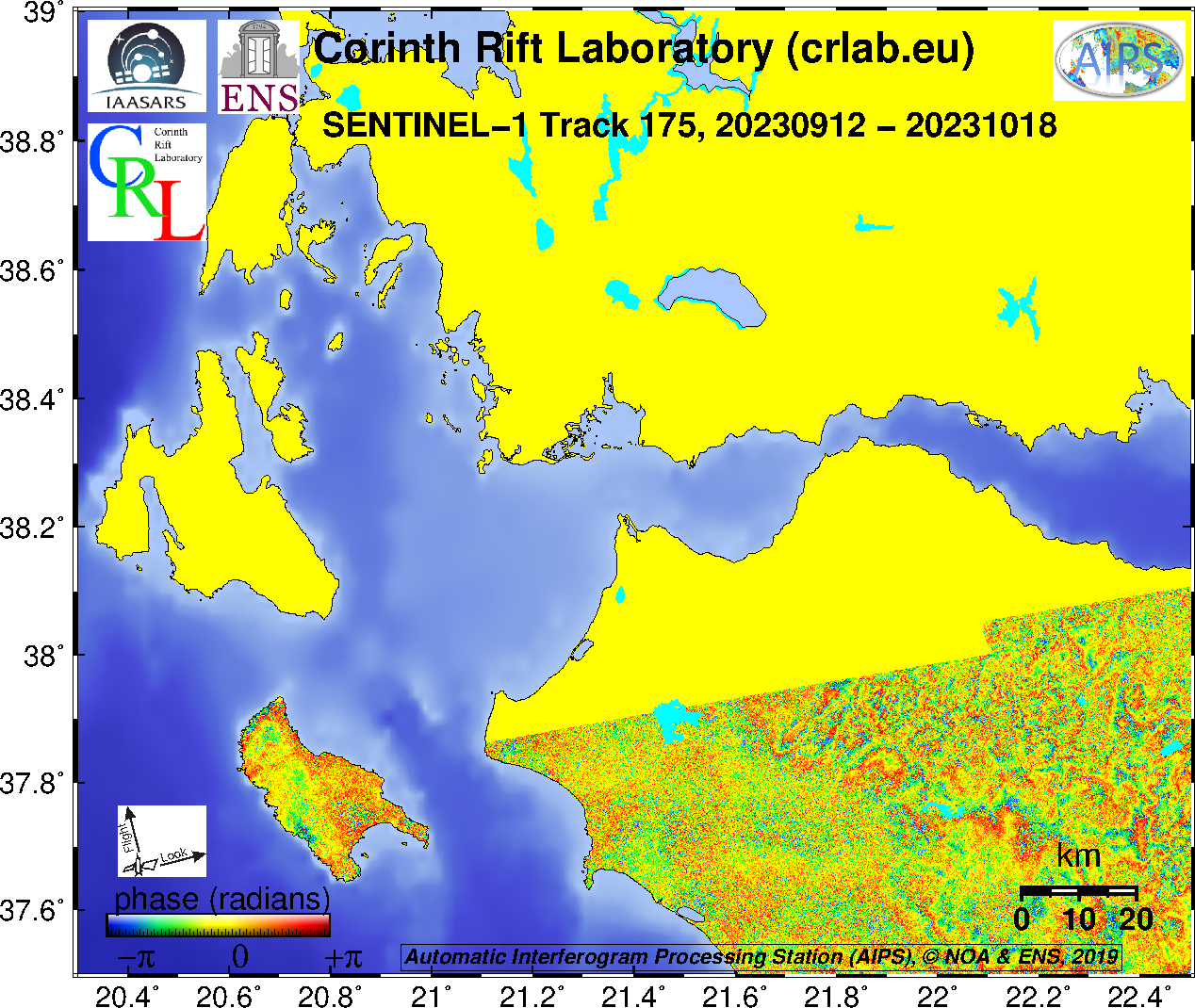
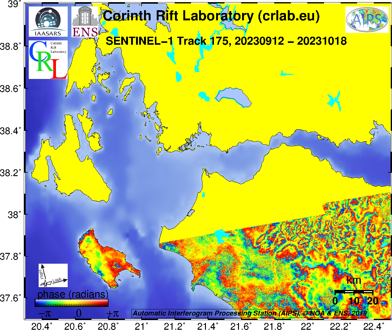
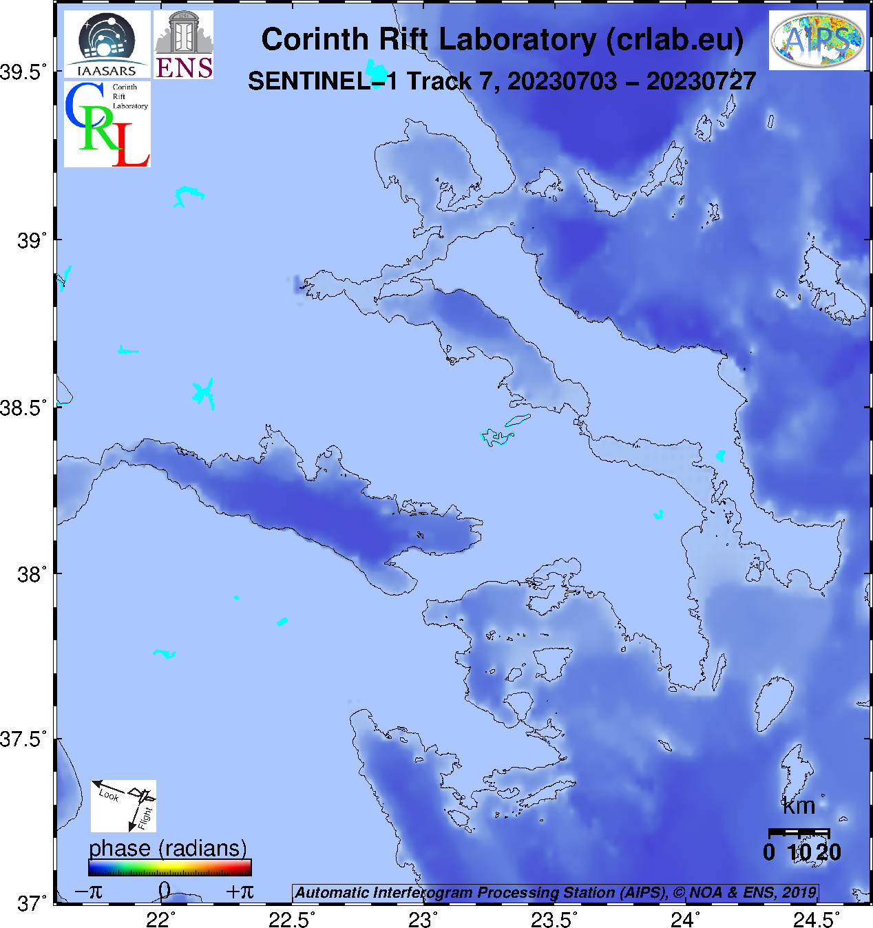
SENTINEL-1 last routine interferogram from AIPS
- Track 80 : unfiltered, filtered
- Track 175 : unfiltered, filtered
- Track 7 : unfiltered, filtered
SENTINEL-1 archived routine interferograms from AIPS
- Track 80
- unfiltered: Figures, high res pngs, geotif phase, geotif amplitude
- filtered: Figures, high res pngs, geotif phase, geotif amplitude
- Track 175
- unfiltered: Figures, high res pngs, geotif phase, geotif amplitude
- filtered: Figures, high res pngs, geotif phase, geotif amplitude
- Track 7
- unfiltered: Figures, high res pngs, geotif phase, geotif amplitude
- filtered: Figures, high res pngs, geotif phase, geotif amplitude
SENTINEL-1 archived interferograms
The interferograms are in GeoTiff format (more details about meta-data)
Ascending (Track 175)
- SNAP (track 175) (caution: phase histogram not flat)
- DLR
- IREA
- DIAPASON
Descending (Track 80)
- SNAP (track 80) (caution: phase histogram not flat)
- DLR
- IREA
- DIAPASON
Coherence
Ascending (Track 175 – from 97 images): Histogram Coherence Coherence_rvb (blue = most coherent)
Descending (Track 80 – from 575 interferograms): Histogram Coherence Coherence_rvb (blue=most coherent)
RAW and SLC data from SAR sensors on board of satellites
Envisat data of the ENS ftp server ‘GNSS‘