Location of the absolute gravity stations
Catégorie : Array
The meteorological array
Links to partners pages
- University of Patras, Laboratory of Atmospheric Physics
- Weather forecast of UPAT-LAP
- Current weather at the HELMOS NOA station
The GNSS array
 Centre National de La Recherche Scientifique – CL GNSS instruments – Stations AIGI, ALIS, ANOC, ARSA, EYPA, GALA, GEYB, KALA, KOUN, KRIN, LAMB, LIDO, MESA, MESO, PAT0, PSAR, PSAT, ROD3, TRIZ, VALI, XILI
 National Observatory of Athens – Stations RLSO, EGIO, PLAT
  University of Patras & Charles University Prague – Stations PVO, RETS
Welcome to the CRL-NFO portal
European scientists and engineers are joining their efforts to investigate fault mechanics, its relationship with earthquakes, fluid flow and the related hazards in the Corinth rift.
The Corinth Rift Laboratory (CRL) is centered between the cities of Patras to the west and Aigion to the east. It is one of the most seismically active zones in Europe.
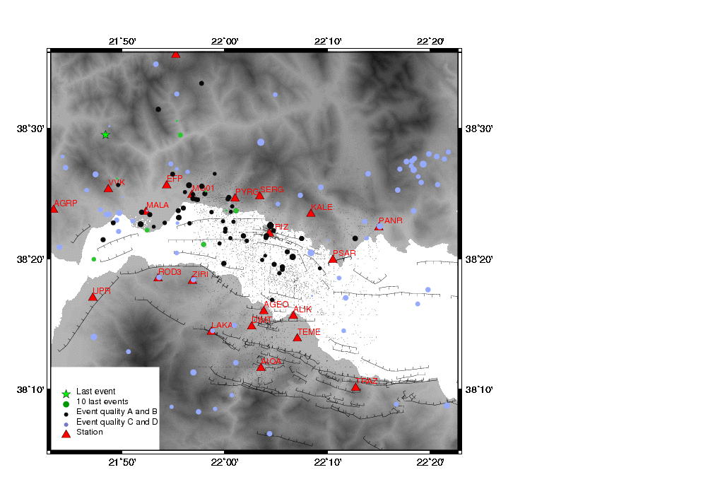
Seismicity of the last 15 days
Maps
1/50.000 topographic maps
Tectonic / geologic maps
 Geological map (Moretti et al, 2003) ) – The Gulf of Corinth: an active half graben?, J. of Geodynamics,36 323-340, 2003
 Compilation of main basement cutting faults of the western Corinth rift from M. Ford (2009) – Data from Ford et al., 2007; Rohais et al., 2007; Flotté et al., 2006, Moretti et al., 2003; Bell et al., 2008. Pre-rifting thrust sheet lithologies are shown in blue and syn-rift sediments in pale yellow.
Seismological array
 CL instruments – Centre National de La Recherche Scientifique – Stations AIOA, AGEO, AGRP, ALIK, DIMT, MALA, MOKI, PANR, PSAM, PSAR, PYRG, RIZA, ROD3, TEME, TRIZ, ZIRI
 HA instruments – Kapodastrian University of Athens – Stations KALE, LAKA
 HL instruments – National Observatory of Athens – Stations DLFA, KLV, RLS
 HP instruments – University of Patras & Charles University Prague – Stations ANX, AXS, EFP, PVO, SERG, UPR, VVK
- The seismological data of the Corinth Rift Observatory can be invoked and cited with the virtual network code _NFOCRL.
For more information click here
[table id=4 /]


