In a 600km2 area south of Aegion to Xylocastro (Fig.1) the onshore syn-rift stratigraphy is divided into three informal groups (Rohais et al. 2007; Ford et al. 2007; Backert et al. in revision).
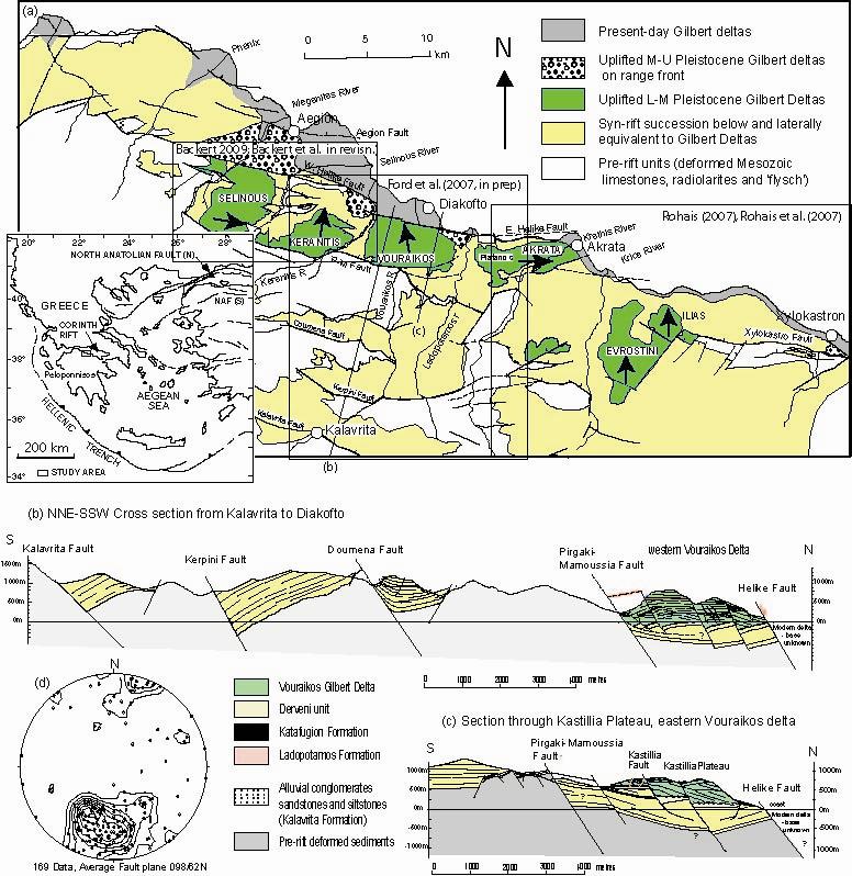
Figure 1. General geology of the central south coast, showing syn rift sediments and major Lower to Middle Pleistocene Gilbert deltas (adapted from Ghisetti et Vezzani 2006; Rohais et al. 2007; Ford et al. 2007; Backert et al. in revision). The areas covered by various authors are indicated.
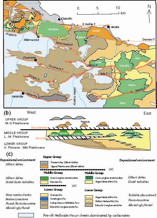
Figure 2. Synthetic map (unpublished) of structure and Plio-Pleistocene syn-rift stratigraphy of the Corinth rift adapted from Rohais et al. (2007), Ford et al. (2007), Ghisetti & Vezzani (2005), Backert et al. (in rev) and unpublished field data (Ford 2009). (b) EW section of lateral correlations.(c) Legend.
Lower Group: 1.3 km alluvial-fluvial sediments in W, 400 m fluvio-lacustrine sediments in NW (south of Aegion), 1.8 km fluvio-lacustrine sediments E of Akrata. All sourced from W –WSW. estimated age :Pliocene-early Pleistocene
Middle Group: Gilbert-type fan deltas, Sourced from S, prograde mainly N, locally NE (Prioni), and NW (Ilias). Up to 1000 m thick. Rift narrows in W (deltas restricted to north of the PM fault), but remains wide in E. Estimated age: early-Middle Pleistocene.
Upper Group: Local onshore deposits of small Gilbert deltas, fluvial terraces, red soil terraces, slope deposits and marine terraces on the range front. All were deposited during uplift of the south coast. Deposition offshore (Bell et al. 2008). Estimated age: Middle to Late Pleistocene
Contact: Mary Ford