Auteur/autrice : crl
Relative gravity data
There is a ongoing project of measurement of ~200 relative gravity points anchored to the absolute ones.
A first reconnaissance was performed in September 2014 to determine the location of the future campaign measurements (mission J. Hinderer, J.D. Bernard)
Documents
Absolute gravity data
A campaign of absolute gravity measurements was carried out from November 25, 2013 to December 5, 2013.
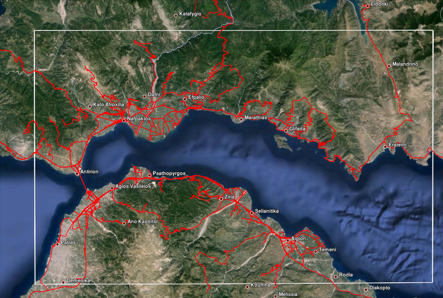
Five absolute points were observed at Patras, Nafpaktos, Panormo, Temeni and Chelmos (see map).
Near each absolute point an auxiliary point was established and connected to the absolute one for easy re-occupation in the future.
The points Temeni and Chelmos were established so as to constitute a calibration base (~1600m of difference of elevation) measurable in less than four hours (good road and time needed for the loop and measurements with relative gravimetre at the points).
Documents:
- Mission report
- KML file with the location of the five absolute points
- Photos of the absolute measurements
The gravity array
Meteorological models and combination with GNSS
Meteorological data
Data of the CRL station of PSAM. This meterological station was installed in 2013 on the northern coast of the gulf, in the central part of the network.
The meteorological array
Links to partners pages
- University of Patras, Laboratory of Atmospheric Physics
- Weather forecast of UPAT-LAP
- Current weather at the HELMOS NOA station
Link to GNSS software and utilities
- Real-time processing of the EUREF PAT0 data with the CNES PPP Wizard – Real-time plot
- Link to PB utility software
Velocities from GNSS
Time series of permanent network
![]() The solutions of the NOA-IAASARS GNSS processing station
The solutions of the NOA-IAASARS GNSS processing station
![]() The solutions of GPSCOPE
The solutions of GPSCOPE
GPS deformation of the Corinth rift

- From Avallone A. et al. , Analysis of eleven years of deformation measured by GPS in the Corinth Rift Laboratory area, C.R. Geoscience, 336, 301-312, 2004

Kinematic GNSS data
See video of kinematic survey on June 16, 2019 – Download the data of June 16, 2019
The coverage of the Corinth Rift Laboratory with kinematic GNSS

Kinematic GNSS observations with three antennas on top of the car (sept 2016)
There are various methods to process the kinematic GNSS data
- local processing / on-line processing
- dual differences / PPP
Most of our dual difference processing calculations are made with the old but good PNAV software. As PNAV requires data at the Ashtech format BES, this requires a difficult part of preprocessing of the data!
For the PPP processing we use locally GIPSY version 6.4 and GIPSY-X
There are also various good on-line PPP processors, see this page
Want to analyze more kinematic GNSS data? Download this file acquired on September 22, 2022 on Trizonia island. The file is mixing static and kinematic data.