Overall programme
- May 7 – May 10: early deployment of instruments by Simon Bufféral and Zoé Dubois
- May 11 – May 12: science meeting at the Navarino Environmental Observatory. Click here to read more.
- May 13 – May 21: core GNSS campaign
- May 22 – May 29: geological campain by Simon Bufféral and Manu Pubellier
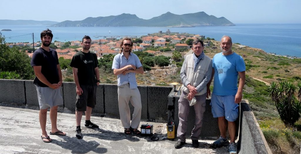
Participants to the campaign
Safe conduct released by the National and Kapodistrian University of Athens
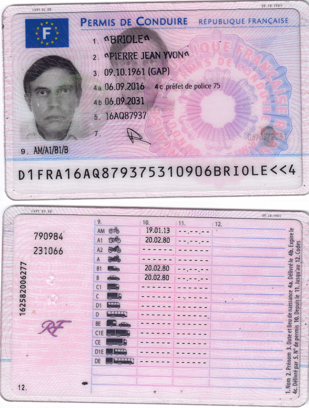
- Pierre Briole (Tuesday 9 – Monday 22 May) – mission order
- Simon Bufféral (Sunday 7 – Monday 29 May)
- Zoé Dubois (Sunday 7 – Sunday 14 May)
- Παναγιώτης Ηλίας (Tuesday 9 – Friday 12 May) – Leaves after Pylos meeting
- Εμμανουέλα Κωνσταντακοπούλου – Cancelled
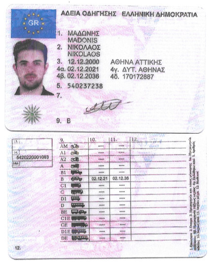
- Νικόλαος Μαδωνής (Saturday 13 – Saturday 20 May)
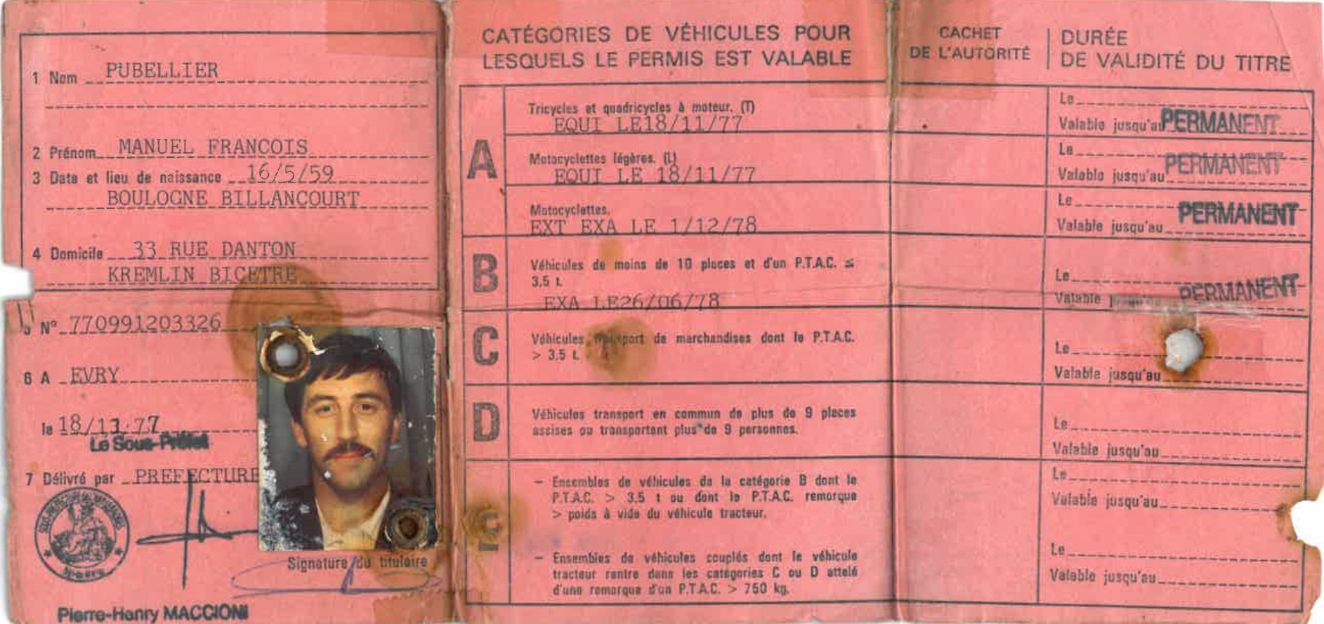
- Manu Pubellier (Tuesday 7 – Monday 29 May)
maps
- Points to be measured
- Greek geodetic points in the 1/50.000 maps
Vehicles
- Car 1: Dacia DUSTER
- Car 2: Nissan Qashqai – rental agreement
- Drivers
- Contats Avance Rent A Car (Theocar)
- Nikos (Avance – Nafpaktos): +30 697 043 8430
- Other mobile Nafpaktos: +30 694 038 88 06
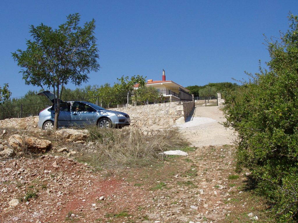
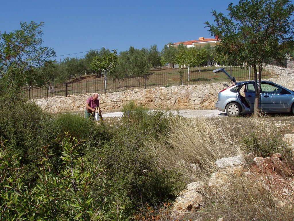
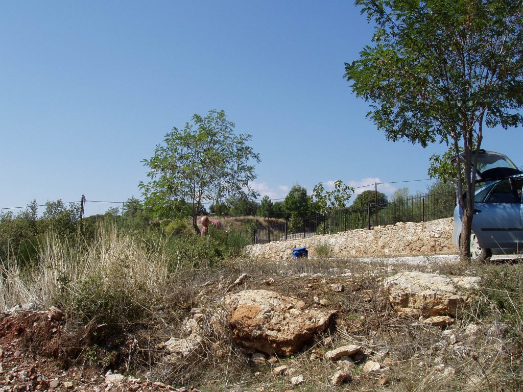
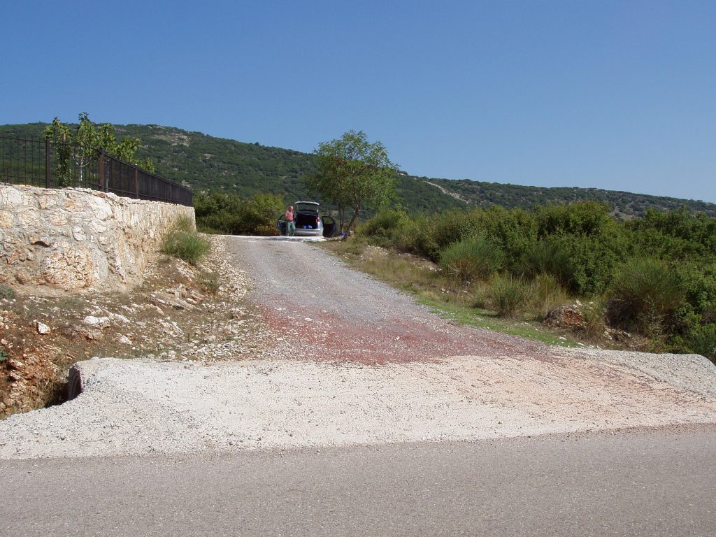
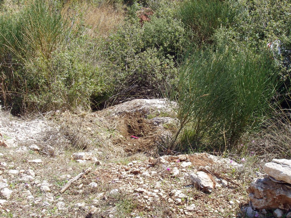
Pictures of the campaign
Click here to see pictures of the campaign
List of planned GNSS points with details
Click here to download KMZ file
- Points measured in the CRL array between 1993 and 1996
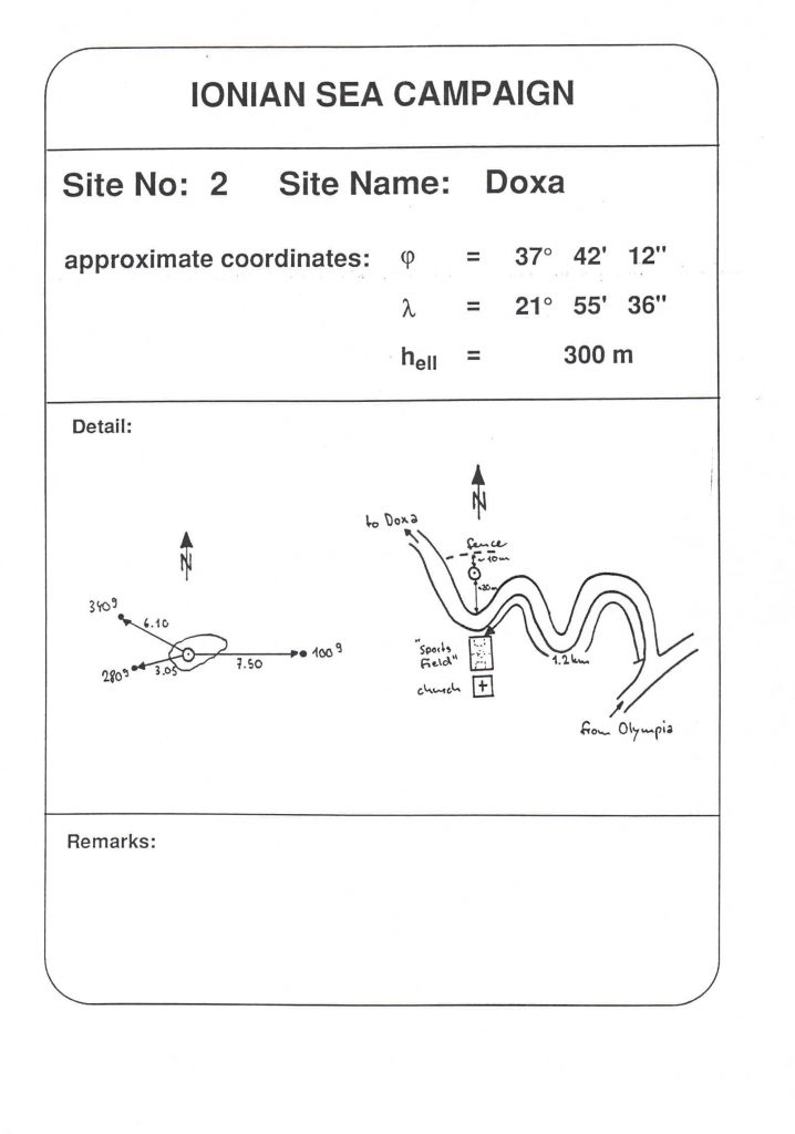
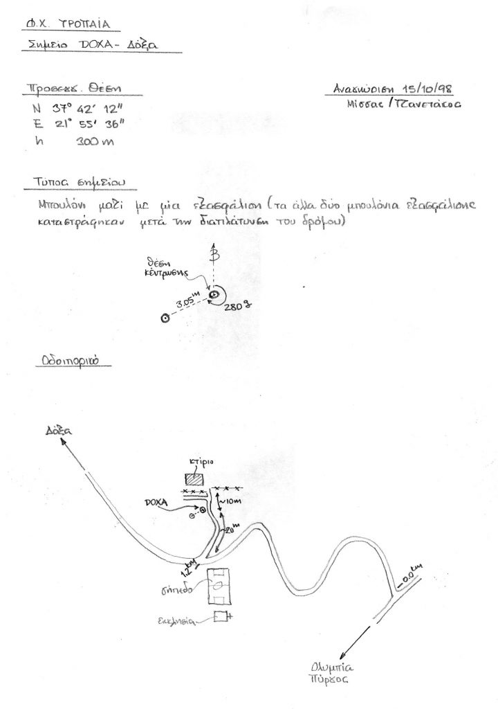
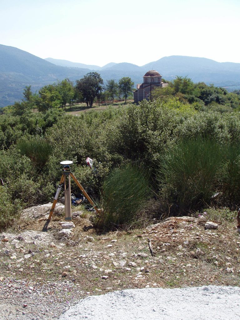
- DOXA – measured on october 15, 1998 (SING 1998) and on october 2, 2006 by Jean-Claude Ruegg and Denis Hatzfeld
- CG47 – Central Greece 1989 – marker – More information here and here – measured on july 10, 1098 (SING 1998) and on july 12, 2000 (SING 2000)
- CG48 – Central Greece 1989 – pillar – measured on july 10, 1998 (SING 1998) and on july 12, 2000 (SING 2000)
- CG49 – Central Greece 1989 – pillar – More information here – measured on july 12, 2000 (SING 2000)
- CG63 – Central Greece 1989 – More information here – measured on july 12, 2000 (SING 2000)
- CG64 – Central Greece 1989 – More information here and here – measured on september 24, 1994 by Pierre Briole and Rodolphe Cattin 12:32-14:09 – P code
- CG65 – Central Greece 1989 – measured on july 8, 2000 (SING 2000)
- CI00 – CRL 1993 – more information here and here
- CJ00 – CRL 1993 – More information here and here – caution: photos are misleading – measured on july 7, 2000 (SING 2000)
- CK00 – CRL 1993 – More information here and here
- CL00 – CRL 1993 – More information here and here
- Point of the SING 1998-2000 array
- Map 234-LN-Nafplio
- LN1A – SING point MARA – measured on july 7, 1998 (SING 1998)
- Map 203-KC-Ligourio
- KC3F – SING point GILS – measured on july 8, 2000 (SING 2000)
- KC6B – SING point DMNA – measured on july 8, 2000 (SING 2000)
- Map 350-RJ-Spetses
- RJ0F – SING point PHEL – measured on july 8, 2000 (SING 2000)
- RJ3E – SING point KOIL – measured on july 8, 2000 (SING 2000)
- RJ56 – SING point DDYM – measured on july 8, 2000 (SING 2000)
- Map 365-RE-Idra
- SE2B – SING point ILOK – measured on july 8, 2000 (SING 2000)
- SE39 – SING point VRMS – measured on july 8, 2000 (SING 2000)
- Map 234-LN-Nafplio
- Second order points measured between 1993 and 1995
- Map 87-EG-Dafni
- EG61 measured in june 1995 by Oxford with name DF97 and on october 5, 1995
- EG87 measured in june 1995 by Oxford with name D135 and on october 4 and 5, 1995
- Map 173-IM-Korinthos
- IM70 measured on May 16 and May 20, 1993 with name CK78 (Zevgolatio)
- IM5B measured on May 20, 1993 with name CK575 more information here
- IM36 measured on september 30, 1994 with name CY272 by Dorothée Streiff and Aggeliki Marinou – P code
- IM12 measured on september 24, 1994 with name CY751 by Pierre Briole and Rodolphe Cattin – single frequency
- Map 137-GQ-Kaparelli
- GQ0E measured on october 13, 1995 with name CX44 by Gregory Durand 08:52-11:39 – P code
- GQ27 measured on september 22, 1994 with name CX470 (Korifi) by Pierre Briole and Rodolphe Cattin – P code [Not scheduled in 2023]
- Map 238-LR-Nemea
- LR21 measured on september 30, 1994 with name 0448 by Dorothée Streiff and Aggeliki Marinou – P code
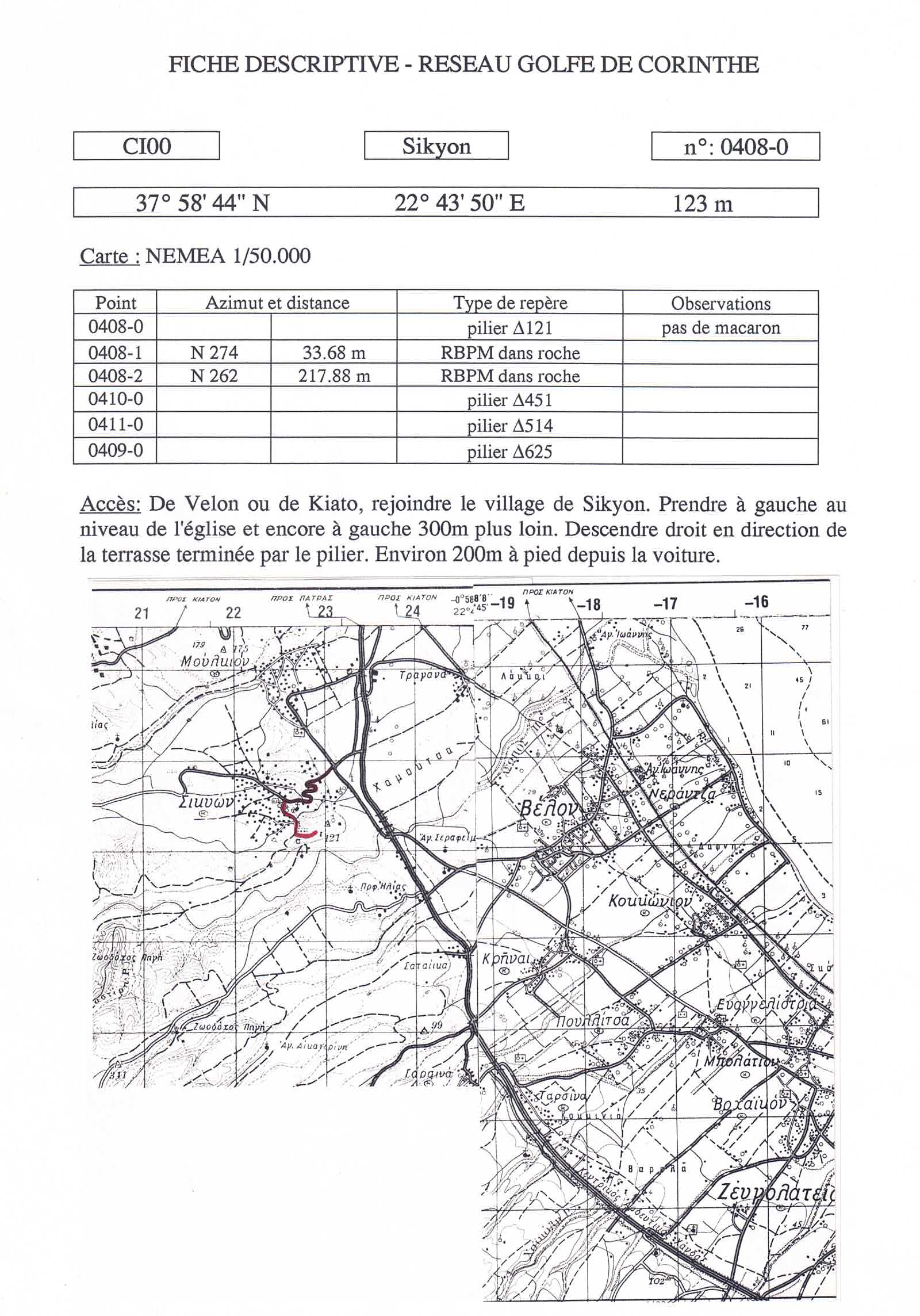
- LR56 measured on May 17, 1993 with name CI451 (Stimaga) by Kostas Kamberos and Alain Simonin – more information here and here
- LR60 measured on May 19, 1993 with name CI514 (Agios Georgios) by Kostas Kamberos and Alain Simonin – more information here and here
- LR59 measured in 1993 with name CI615 (Stimaga) – more information here [Not scheduled in 2023]
- IM59 measured in 1993 with name CJ353 (Patima) – more information here [Not scheduled in 2023]
- LR84 Foukas measured on october 10, 1995 with name CJ73 by Kostas Kambery and Gregory Durand 14:13-15:42 – P code
- Map 136-GP-Kandhila
- GP07 measured on october 9, 1995 with name CD65 by Roland Machenbaum 12:45-15:08 – codeless
- GP22 measured on october 9, 1995 with name CD69 by Roland Machenbaum 10:19-14:02 – codeless
- GP35 measured on october 8, 1995 with name CD73 by Roland Machenbaum 15:32-19:28 – codeless
- GP49 measured on october 10, 1995 with name CD90 by Roland Machenbaum 06:57-10:20 – codeless
- GP6B measured on september 28, 1994 with name 1039 (Goura) by Dorothée Streiff and Aggeliki Marinou – P code
- Map 361-SA-Tripoli
- SA52 measured on october 13, 1995 with name T624 by Roland Machenbaum 06:26-10:36 – codeless
- SA61 measured on october 13, 1995 with name T831 by Roland Machenbaum 11:21-14:22 – codeless
- SA70 measured on october 13, 1995 with name T704 by Roland Machenbaum 13:30-15:51 – P code
- SA8C measured on october 13, 1995 with name T665 by Roland Machenbaum 09:30-12:56 – P code
- Map 234-LN-Nafplio
- LN7E measured on october 13, 1995 with name CK70 by Jérôme Ammann and Kostas Kamberos 13:28-15:34 – P code
- LN75 measured on october 13, 1995 with name CK24 by Jérôme Ammann and Kostas Kamberos 14:22-16:07 -codeless
- LN80 measured on october 13, 1995 with name CK22 by Jérôme Ammann and Kostas Kamberos 17:17-18:49 – codeless
- Map 346-RF-Sofikon
- RF1A measured on october 13, 1995 with name CK47 by Jérôme Ammann and Kostas Kamberos 07:59-10:56 – codeless
- RF1F measured on october 13, 1995 with name CK78 by Jérôme Ammann and Kostas Kamberos 09:58-11:34 – codeless
- RF2E measured on october 10, 1995 with name CK12 by Jérôme Ammann 12:07-13:36 – P code
- RF3A measured on september 29, 1994 with name 0018 (Agios Theodori) by Dorothée Streiff and Aggeliki Marinou 12:28-14:34 – P code
- Map 87-EG-Dafni
